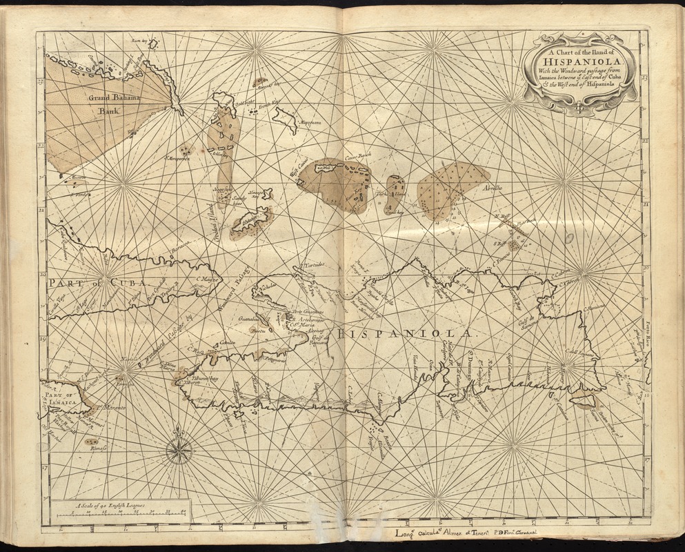
A chart of the iland of Hispaniola : with the Windward passage from Iamaica betwene ye east end of Cuba & the west end of Hispaniola
Item Information
- Title:
- A chart of the iland of Hispaniola : with the Windward passage from Iamaica betwene ye east end of Cuba & the west end of Hispaniola
- Date:
-
[1737]
- Format:
-
Maps/Atlases
- Location:
-
Boston Public Library
Norman B. Leventhal Map & Education Center - Collection (local):
-
Norman B. Leventhal Map & Education Center Collection
- Subjects:
-
Nautical charts--Hispaniola--Early works to 1800
Nautical charts--Windward Passage--Early works to 1800
Hispaniola--Maps--Early works to 1800
- Places:
-
Windward Passage
Hispaniola (island)
- Extent:
- 1 map : hand col. ; 42 x 53 cm.
- Terms of Use:
-
No known copyright restrictions.
No known restrictions on use.
- Publisher:
-
London :
Printed & sold by Page and Mount
- Scale:
-
Scale [ca. 1:1,790,000]
- Language:
-
English
- Notes:
-
Relief shown pictorially. Depths shown by soundings.
In the English pilot, the fourth book. London : Printed for William Mount and Thomas Page, 1737.
Stippling on the mountains differs from chart in the 1716 edition.
- Notes (date):
-
This date is inferred.
- Identifier:
-
06_01_010275
- Call #:
-
G1106.P5 E54 1737
- Barcode:
-
30000003251191