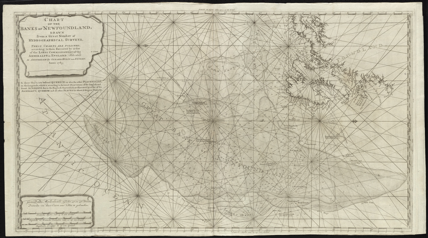
Chart of the Banks of Newfoundland, drawn from a great number of hydrographical surveys, these charts are followed, according to them executed by order of the Lords Commissioners of the Admiralty in England
This map is also available in American Revolutionary Geographies Online (ARGO), a collections portal especially built for material relating to the American Revolutionary War Era. Visit ARGO to learn more about this item and explore the historical geography of North America in the late eighteenth century.
Item Information
- Title:
- Chart of the Banks of Newfoundland, drawn from a great number of hydrographical surveys, these charts are followed, according to them executed by order of the Lords Commissioners of the Admiralty in England
- Title (alt.):
-
Eene verzameling van nieuwe zee-kaarten van Noord-America in het groot beginnende van Kaap Charles, of de Golf van St. Laurens, tot aan de Golf van Mexico
- Creator:
- Keulen, Gerard van
- Date:
-
1783
- Format:
-
Maps/Atlases
- Location:
- George Washington's Mount Vernon
- Collection (local):
-
Richard H. Brown Revolutionary War Map Collection at Mount Vernon
- Subjects:
-
Nautical charts--Newfoundland and Labrador--Early works to 1800
Coasts--Newfoundland and Labrador--Maps--Early works to 1800
Grand Banks of Newfoundland--Maps--Early works to 1800
- Places:
-
Grand Banks of Newfoundland
- Extent:
- 1 chart ; 59 x 108 cm.
- Terms of Use:
-
No known copyright restrictions.
This work is licensed for use under a Creative Commons Attribution Non-Commercial Share Alike License (CC BY-NC-SA).

- Publisher:
-
Amsterdam :
Gerard Hulst van Keulen
- Scale:
-
Scale [ca. 1:1,160,000]
- Language:
-
English
Dutch
- Catalog Record:
-
MVLA record
- Notes:
-
Second of 6 charts bound in a set, apparently an English version of Van Keulen's "Eene verzameling van nieuwe zee-karten van Noord-America," intended for use during the American Revolution.
Prime meridians: Paris, Tenerife, and Greenwich.
Oriented with north to the right.
Depth shown by soundings.
Chart in English. Scale bar in Dutch.
- Identifier:
-
06_01_009617
- Barcode:
-
30000003873544


