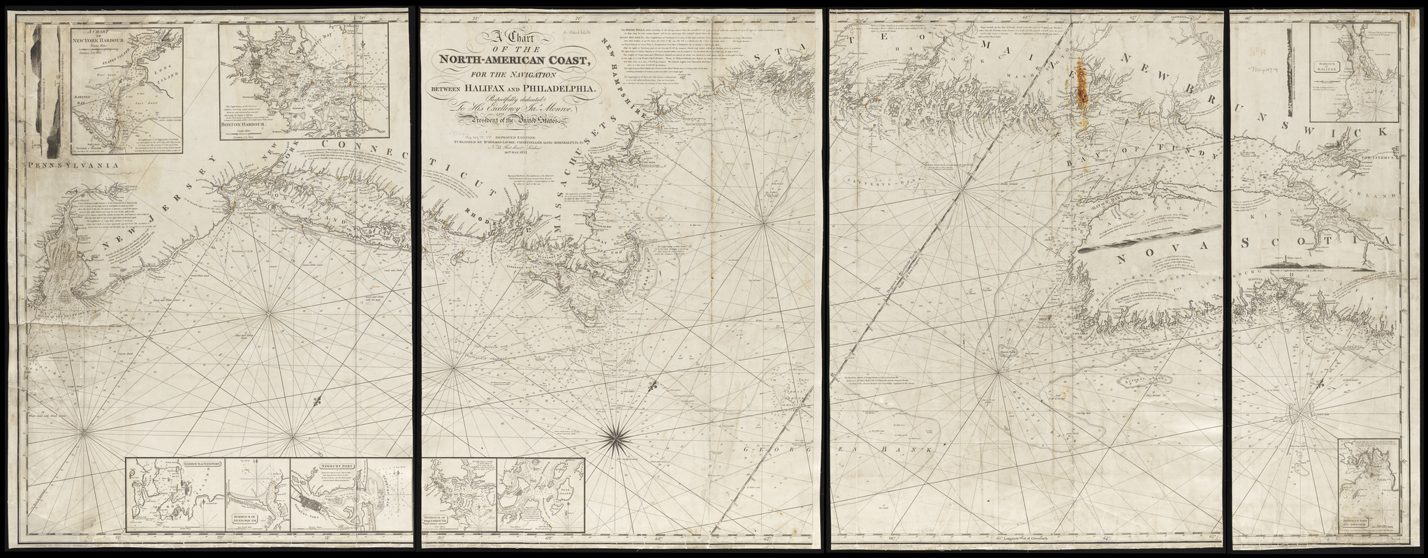
A chart of the North-American coast, for the navigation between Halifax and Philadelphia
Item Information
- Title:
- A chart of the North-American coast, for the navigation between Halifax and Philadelphia
- Publisher:
- Laurie, Richard Holmes
- Date:
-
1834
- Format:
-
Maps/Atlases
- Location:
-
Boston Public Library
Norman B. Leventhal Map & Education Center - Collection (local):
-
Norman B. Leventhal Map & Education Center Collection
- Subjects:
-
Coasts--Middle Atlantic States--Maps
Coasts--New Brunswick--Maps
Coasts--Nova Scotia--Maps
Coasts--New England--Maps
Nautical charts--Middle Atlantic States--Maps
Nautical charts--New Brunswick--Maps
Nautical charts--Nova Scotia--Maps
Nautical charts--New England--Maps
Atlantic Coast (Canada)--Maps
Atlantic Coast (Middle Atlantic States)--Maps
Atlantic Coast (New England)--Maps
- Places:
-
Middle Atlantic (area)
CanadaProvince of New Brunswick (province)
New England (area)
- Extent:
- 1 map on 4 sheets ; 78 x 204 cm, on sheets 83 x 60 cm or smaller
- Terms of Use:
-
No known copyright restrictions.
No known restrictions on use.
- Publisher:
-
London :
Published by Rd. Holmes Laurie, chartseller to the Admiralty, &c. &c., no. 53 Fleet Street
- Edition:
- Improved edition
- Scale:
-
Scale approximately 1:600,000
- Language:
-
English
- Notes:
-
Relief shown by hachures. Depths shown by soundings.
Oriented with north to the upper right.
"Respectfully dedicated to His Excellency Jas. Monroe, late President of the United States."
Includes notes, 9 insets and 5 coastal views.
Insets: A chart of New York Harbour -- Boston Harbour -- Harbour of Newport -- Harbour of Annis-Squam -- Newbury Port -- Harbour of Portsmouth -- [Portland Harbour] -- Harbour of Halifax -- Harbour of St. John, New Brunswick.
- Identifier:
-
06_01_015449
- Call #:
-
G3716.P5 1834 .C43
- Barcode:
-
39999085937082


