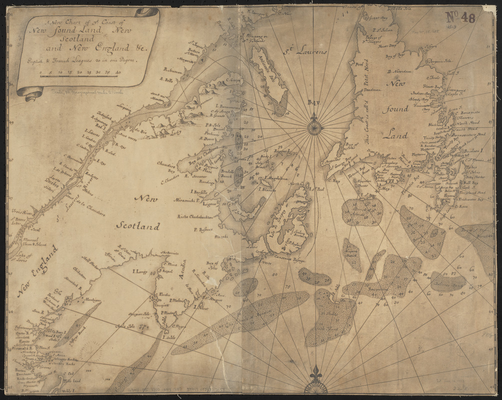
A new chart of ye coast of New Found Land, New Scotland and New England &c.
Item Information
- Title:
- A new chart of ye coast of New Found Land, New Scotland and New England &c.
- Title (alt.):
-
New chart of ye coast of Newfoundland, New Scotland and New England &c.
- Date:
-
1880
- Format:
-
Maps/Atlases
- Location:
-
Boston Public Library
Norman B. Leventhal Map & Education Center - Collection (local):
-
Norman B. Leventhal Map & Education Center Collection
- Subjects:
-
Atlantic Coast (Canada)--Maps
Atlantic Coast (New England)--Maps
New Brunswick--Maps
New England--Maps
Newfoundland and Labrador--Maps
Nova Scotia--Maps
- Places:
-
CanadaProvince of New Brunswick (province)
New England (area)
- Extent:
- 1 map ; 46 x 58 cm
- Terms of Use:
-
No known copyright restrictions.
No known restrictions on use.
- Publisher:
-
[Place of publication not identified] :
[publisher not identified]
- Scale:
-
Scale approximately 1:2,400,000
- Language:
-
English
- Notes:
-
Reproduction of a manuscript map drawn approximately 1700. Original held by the British Museum.
Depths shown by soundings.
- Notes (citation):
-
List of maps of Boston published subsequent to 1600, page 13
- Identifier:
-
06_01_015448
- Call #:
-
G3411.P5 1700 .N49 1880
- Barcode:
-
39999085937058


