Toggle navigation
LMEC Home
Exhibitions
Georeferencing
Tools for Teachers
Collections
My Favorites
Sign Up / Log In
Search
Search the map portal
Map Collection
Map Collection
Map Sets
Search
Search
Search for
Search In
All Fields
Creator
Title
Subject
Place
Search All Digital Collections
Advanced Search
172 Results
My Search
Start Over
More Like
commonwealth:z603vg47w
Remove constraint More Like: commonwealth:z603vg47w
Filter your Search
Place
North and Central America
135
United States
61
New Jersey
35
Canada
22
North America
17
West Indies
17
New York
16
Pennsylvania
15
more
Place
»
Topic
New Jersey--Maps
37
United States--History--Revolution, 1775-1783--Maps
20
United States--Maps
20
North America--Maps
17
West Indies--Maps
17
New York (State)--Maps
15
Pennsylvania--Maps
15
Canada--Maps
14
more
Topic
»
Date
Date range begin
–
Date range end
Current results range from
1750
to
1909
View distribution
Creator
Reid, John, 1764?-1828
10
Farwell, John Whittemore, 1843-1929
9
Kitchin, Thomas, 1718-1784
9
Bellin, Jacques Nicolas, 1703-1772
8
Carleton, Osgood, 1742-1816
6
Tanner, Benjamin, 1775-1848
6
Anderson, Alexander, 1775-1870
5
Doolittle, Amos, 1754-1832
5
more
Creator
»
Format
Maps/Atlases
172
Manuscripts
13
Georeferenced
Yes
22
No
150
Collection
American Revolutionary War-Era Maps
154
American Antiquarian Society Collection
138
Norman B. Leventhal Map Center Collection
19
William L. Clements Library Collection
14
Boston and New England Maps
1
Maritime Charts and Atlases
1
New York Public Library Collection
1
Available to use
No known restrictions
19
Creative Commons license
2
Search Constraints
Sort by relevance
relevance
title
date (asc)
date (desc)
Number of results to display per page
100 per page
10
per page
20
per page
50
per page
100
per page
View results as:
grid view
map view
Search Results
1.
An Exact map of New England, New York, Pensylvania & New Jersey, : from the latest surveys
2.
[Map of parts of Pennsylvania, New York and New Jersey]
3.
The provinces of New York, and New Jersey, : with part of Pensilvania [sic], and the province of Quebec
4.
Bridge from Staten Island to the Jersies, by Cn. Laird's description
5.
A chorographical map of the country round Philadelphia = Carte particuliere des environs de Philadelphia
6.
A compleat plan of part of the province of Pennsylvania East and West Jersey shewing the transactions of the royal army under...
7.
From Freehold toward Trenton
8.
An historical map of Pennsylvania : showing the Indian names of streams and villages, and paths of travel : the sites of old...
9.
Manuscript maps of U.S. states, possibly drawn by a schoolchild
10.
Map of American camp in New Jersey and surrounding countryside
11.
Map of the canals and rail roads for transporting anthracite coal from the several coal fields to the city of New York
12.
A map of the Delaware and Chesapeak bays with the peninsula between them
13.
Map of the rail roads of New Jersey 1887
14.
Map of the State of New York with part of the states of Pennsylvania, New Jersey &c
15.
A new and accurate map of New Jersey, from the best authorities
16.
New Jersey
17.
New Jersey showing forest area and its relation to the principal watersheds
18.
Northern New Jersey
19.
Northern New Jersey, showing the iron-ore & limestone districts
20.
Part of the modern counties of Monmouth, Middlesex, Somerset, Hunterdon, Mercer, Burlington, and Ocean in New Jersey and...
21.
Part of the modern counties of Union, Somerset, Hunterdon, Morris, Essex, Bergen, Passaic, Sussex, and Warren in New Jersey and...
22.
A plan of the northern part of New Jersey : shewing the positions of the American and British armies after crossing the North...
23.
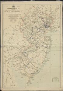
Post route map of the State of New Jersey showing post offices with the intermediate distances on mail routes in operation on...
24.
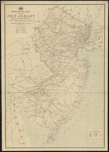
Post route map of the state of New Jersey showing post offices with the intermediate distances on mail routes in operation on...
25.
Post route map of the states of Pennsylvania, New Jersey, Delaware, and Maryland and of the District of Columbia with adjacent...
26.
The principal part of the province of New Jersey shewing the road and distances to the several towns between the North River...
27.
Rand, McNally & Co.'s New Jersey
28.
Relief map of New Jersey
29.
The road from New Bridge and Hackinsack to Burlington
30.
Seat of war in the environs of Philadelphia
31.
Situation of ye rebels just before the attack upon Trenton
32.
Southern New York and northern New Jersey
33.
The State of New Jersey : from original surveys based on the triangulation of the U.S. Coast and Geodetic Survey
34.
The state of New Jersey : economic geology
35.
The state of New Jersey, compiled from the most authentic information
36.
A survey of the empire group : with a complete distance table, a compendious index of cities and post offices, with populations...
37.
A survey of the empire group : with a complete distance table, a compendious index of cities and post offices, with populations...
38.
1st. sheet of De Witt's state-map of New York
39.
An accurate map of North America
40.
An accurate map, of the District of Maine : being part of the commonwealth of Massachusetts
41.
An Accurate map of the United States of America. : According to the Treaty of Peace of 1783
42.
An accurate map of the West Indies, : containing the Bahama & Carribe islands, the Great & Little Antilles, with the Leward and...
43.
An accurate map of the West Indies
44.
An Accurate map of the West Indies, with the adjacent coast
45.
An accurate map of the West Indies with the adjacent coast of America
46.
An Accurate map of the West Indies with the adjacent coast of America. 1796
47.
An accurate plan of the town of Boston and its vicinity : exhibiting a ground plan of all the streets, lanes, alleys, wharves,...
48.
America Septentrionalis : a Domino d'Anville in Galliis edita nune in Anglia Coloniss in Interiorem Virginiam deductis nec non...
49.
Amerique Septentrionale
50.
Amplissima regionis Mississipi : seu provinciae Ludoviciana à R.P. Ludovico Hennepin Francise Miss. in America Septentrionali...
51.
Boston its environs and harbour, : with the rebels works raised against that town in 1775, from the observations of Lieut. Page...
52.
The British governments in Nth. America : laid down agreeable to the proclamation of Octr. 7, 1763
53.
Carolinae Floridae nec non insularum Bahamensium : cum partibus adjacendibus delineatio ad Exemplar Londinense in lucem edita a...
54.
Carte de la Caroline et Georgie. : Pour servir à l'Histoire générale des voyages
55.
Carte de la Caroline et Georgie. : Pour servir à l'Histoire générale des voyages
56.
Carte de la Floride, de la Louisiane, et pays voisins. : Pour servir à l'Histoire générale des voyages
57.
Carte de la Louisiane et de la Floride
58.
Carte de la Nouvelle Angleterre, Nouvelle Yorck, et Pensilvanie. : Pour servir à l'Histoire générale des voyages
59.
Carte de la Virginie, : de la Baye Chesapeack, et pays voisins. : Pour servir à l'Histoire générale des voyages. : Tirée...
60.
Carte de l'Amerique Septentrionale depuis le 28 degré de latitude jusqu'au 72
61.
Carte des pays connus sous le nom de Canada, : dans laquelle sont distinguées les possessions françoises, et angl?
62.
[Chart of Boston Harbor and the surrounding areas]
63.
Connecticut from the best authorities
64.
Connecticut from the best authorities
65.
A Correct chart of the West India islands : engraved for Malham's naval gazetteer
66.
A correct map of the state of Vermont from actual survey; : exhibiting the county andtown lines, rivers, lakes, ponds
67.
A correct map of the United States of North America. : Including the British and Spanish territories, carefully laid down...
68.
A Correct plan of the environs of Quebec, : and the battle fought on the 13th September, 1759: together with a particular...
69.
An Exact map of the province of Quebec with part of New York & New England from the latest surveys
70.
Florida from the latest authorities
71.
A General map of North America
72.
A general map of North America
73.
A General map of North America; : from the latest observations
74.
Georgia from the latest authorities
75.
L'Isle de Terre-Neuve, l'Acadie, ou la Nouvelle Ecosse, : l'Isle St. Jean et la partie orientale du Canada
76.
Les Isles Antilles et le Golfe du Méxique
77.
Karte von den seen in Canada
78.
A Map of Connecticut and Rhode Island, with Long Island Sound, &c
79.
Map of Genessee Lands
80.
A Map of New England & ye country adjacent, : extending northward to Quebec, & westward to Niagara, on Lake Ontario; shewing...
81.
A map of North America and the West Indies
82.
A Map of North America from the latest discoveries 1798
83.
A Map of that part of America which was the principal seat of war in 1756
84.
[Map of the area along the Saint Croix River in Maine and New Brunswick]
85.
A Map of the British dominions in North America as settled by the late treaty of Peace 1763
86.
A map of the British empire, in North America
87.
A map of the coast of New England from Staten Island to the island of Breton
88.
Map of the commonwealth of Massachusetts exclusive of the district of Maine : compiled pursuant to an act of the General Court...
89.
A Map of the country between Crown Point and Ford Edward
90.
Map of the District of Maine Massachusetts : compiled from actual surveys made by order of the General Court, and under the...
91.
Map of the European settlements in North America
92.
Map of the European settlements in South America and on the western coast of Africa
93.
Map of the European settlements in the West Indies
94.
A Map of the new governments, of East & West Florida
95.
A Map of the present seat of war in North America
96.
Map of the province of West Florida
97.
A Map of the seat of the late war at Boston in the state of Massachusetts
98.
A map of the state of Pennsylvania
99.
A map of the state of Vermont
100.
A map of the states of New Hampshire and Vermont
‹ Prev
Next ›
1
2

![[Map of parts of Pennsylvania, New York and New Jersey]](https://bpldcassets.blob.core.windows.net/derivatives/images/commonwealth:6108vt40m/image_thumbnail_300.jpg)


![[Chart of Boston Harbor and the surrounding areas]](https://bpldcassets.blob.core.windows.net/derivatives/images/commonwealth:6108vs71d/image_thumbnail_300.jpg)


![[Map of the area along the Saint Croix River in Maine and New Brunswick]](https://bpldcassets.blob.core.windows.net/derivatives/images/commonwealth:6108vt00n/image_thumbnail_300.jpg)


