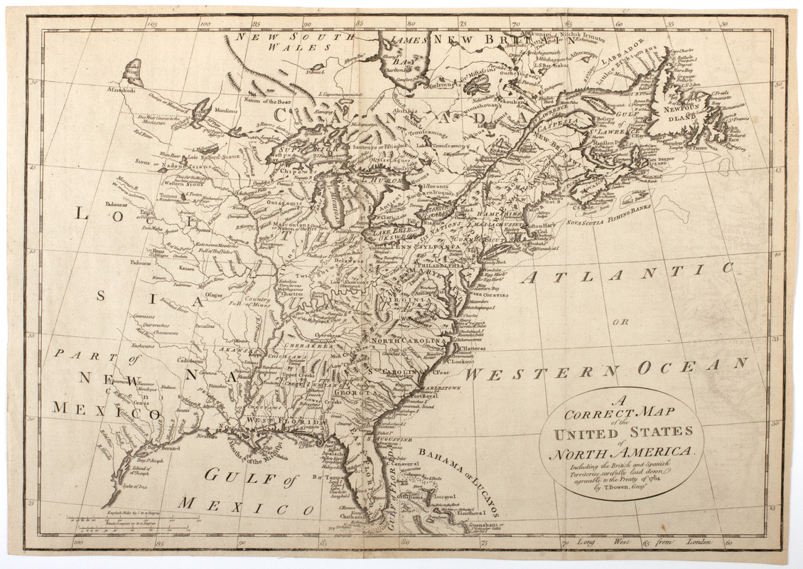
A correct map of the United States of North America. : Including the British and Spanish territories, carefully laid down agreeable to the Treaty of 1784
This map is also available in American Revolutionary Geographies Online (ARGO), a collections portal especially built for material relating to the American Revolutionary War Era. Visit ARGO to learn more about this item and explore the historical geography of North America in the late eighteenth century.
Item Information
- Title:
- A correct map of the United States of North America. : Including the British and Spanish territories, carefully laid down agreeable to the Treaty of 1784
- Description:
-
Subject: Map of the United States, the Louisiana territory, part of New Mexico and part of Canada. Also shows locations of Native American lands.
- Creator:
- Bowen, Thomas Bartholomew, 1742?-1805
- Name on Item:
-
by T. Bowen, geogr.
- Date:
-
[1790]
- Format:
-
Maps/Atlases
- Location:
- American Antiquarian Society
- Collection (local):
-
American Antiquarian Society Collection
- Subjects:
-
Indians of North America--Land tenure
United States--Maps
- Places:
-
United States
- Extent:
- 1 map : engraving ; 32 x 45 cm., on sheet 33 x 46 cm.
- Terms of Use:
-
Public Domain/No known restrictions on use. Contact host institution to download image.
Contact host institution for more information.
- Publisher:
-
London :
[s.n.]
- Scale:
-
Scale not given
- Language:
-
English
- Catalog Record:
-
http://catalog.mwa.org/vwebv/holdingsInfo?bibId=483938
- Notes:
-
Relief shown pictorially.
At top: Engraved for Bankes's New system of universal geography, published by royal authority.
From Bankes, T. New royal and authentic system of universal geography, London, 1790.
- Notes (date):
-
This date is inferred.


