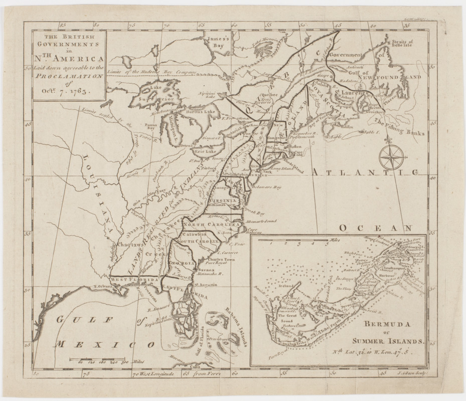
The British governments in Nth. America : laid down agreeable to the proclamation of Octr. 7, 1763
This map is also available in American Revolutionary Geographies Online (ARGO), a collections portal especially built for material relating to the American Revolutionary War Era. Visit ARGO to learn more about this item and explore the historical geography of North America in the late eighteenth century.
Item Information
- Title:
- The British governments in Nth. America : laid down agreeable to the proclamation of Octr. 7, 1763
- Title (uniform):
-
Gentleman's magazine (London, England)
- Description:
-
Subject: Map of the United States and Canada, showing the land between the colonies and Louisiana as "lands reserved for the Indians." Includes inset map of the Bermuda islands.
- Engraver:
- Gibson, J. (John), active 1750-1792
- Name on Item:
-
J. Gibson sculp.
- Date:
-
[1763]
- Format:
-
Maps/Atlases
- Location:
- American Antiquarian Society
- Collection (local):
-
American Antiquarian Society Collection
- Subjects:
-
Indians of North America--Land tenure
United States--Maps
Canada--Maps
Bermuda Islands--Maps
- Places:
-
United States
Bermuda (territory)
Canada
- Extent:
- 1 map : engraving ; 21 x 24 cm., on sheet cm.
- Terms of Use:
-
Public Domain/No known restrictions on use. Contact host institution to download image.
Contact host institution for more information.
- Publisher:
-
London :
[s.n.]
- Scale:
-
Scale [ca. 1:15,000,000]
- Language:
-
English
- Catalog Record:
-
http://catalog.mwa.org/vwebv/holdingsInfo?bibId=489778
- Notes:
-
Prime meridian: Ferro.
Relief shown pictorially.
Inset: Bermuda or Summer Islands.
"Gent. mag."
From Gentleman's magazine, London, 1763.
- Notes (date):
-
This date is inferred.


