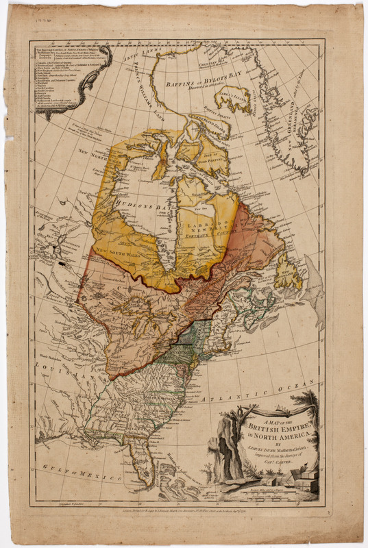
A map of the British empire, in North America
This map is also available in American Revolutionary Geographies Online (ARGO), a collections portal especially built for material relating to the American Revolutionary War Era. Visit ARGO to learn more about this item and explore the historical geography of North America in the late eighteenth century.
Item Information
- Title:
- A map of the British empire, in North America
- Description:
-
Subject: Map of the United States and Canada. Shows locations of various Native American peoples. Cartouche at lower right shows a crown threaded through a cloth hanging between two trees with boxes marked "P.F." and "C.D." piled on the ground.
- Creator:
- Dunn, Samuel, -1794
- Publisher:
- Robert Sayer and John Bennett (Firm)
- Name on Item:
-
By Samuel Dunn, mathematician, improved from the surveys of Capt. Carver.
- Date:
-
1776
- Format:
-
Maps/Atlases
- Location:
- American Antiquarian Society
- Collection (local):
-
American Antiquarian Society Collection
- Subjects:
-
United States--Maps
Canada--Maps
- Places:
-
United States
Canada
- Extent:
- 1 map : engraving, hand colored ; 48 x 30 cm., on sheet 55 x 36 cm.
- Terms of Use:
-
Public Domain/No known restrictions on use. Contact host institution to download image.
Contact host institution for more information.
- Publisher:
-
London :
Printed for R. Sayer & J. Bennett, map & sea chartsellers, no. 53, Fleet Street, as the Act directs.
- Scale:
-
Scale [ca. 1:12,500,000]
- Language:
-
English
- Catalog Record:
-
http://catalog.mwa.org/vwebv/holdingsInfo?bibId=489716
- Notes:
-
Prime meridian: Ferro.
Relief shown pictorially.
- Notes (date):
-
Augst. 17th, 1776


