A General map of North America; : from the latest observations
This map is also available in American Revolutionary Geographies Online (ARGO), a collections portal especially built for material relating to the American Revolutionary War Era. Visit ARGO to learn more about this item and explore the historical geography of North America in the late eighteenth century.
Item Information
- Title:
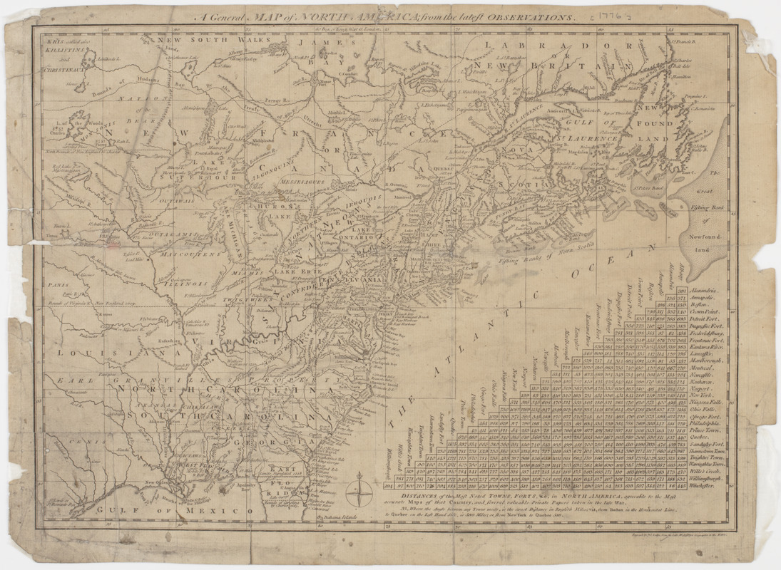
- A General map of North America; : from the latest observations
- Title (uniform):
-
North-American and West-Indian gazetteer
- Description:
-
Subject: Map of the United States and Canada west to Louisiana. Includes a table of distances between towns and forts in North America.
- Name on Item:
-
Engrav'd by Jno. Lodge, from the late Mr. Jefferys geographer to the King.
- Date:
-
[1778]
- Format:
-
Maps/Atlases
- Location:
- American Antiquarian Society
- Collection (local):
-
American Antiquarian Society Collection
- Subjects:
-
United States--Maps
Canada--Maps
- Places:
-
United States
Canada
- Extent:
- 1 map : engraving ; 28 x 39 cm., on sheet 31 x 42 cm.
- Terms of Use:
-
Public Domain/No known restrictions on use. Contact host institution to download image.
Contact host institution for more information.
- Publisher:
-
London :
[s.n.]
- Scale:
-
Scale [ca. 1:10,500,000]
- Language:
-
English
- Catalog Record:
-
http://catalog.mwa.org/vwebv/holdingsInfo?bibId=489836
- Notes:
-
Relief shown by hachures.
"Distances of the most noted towns, forts &c. in North America ... "
From the North-American and West-Indian gazetteer, London, 1778.
- Notes (date):
-
This date is inferred.


