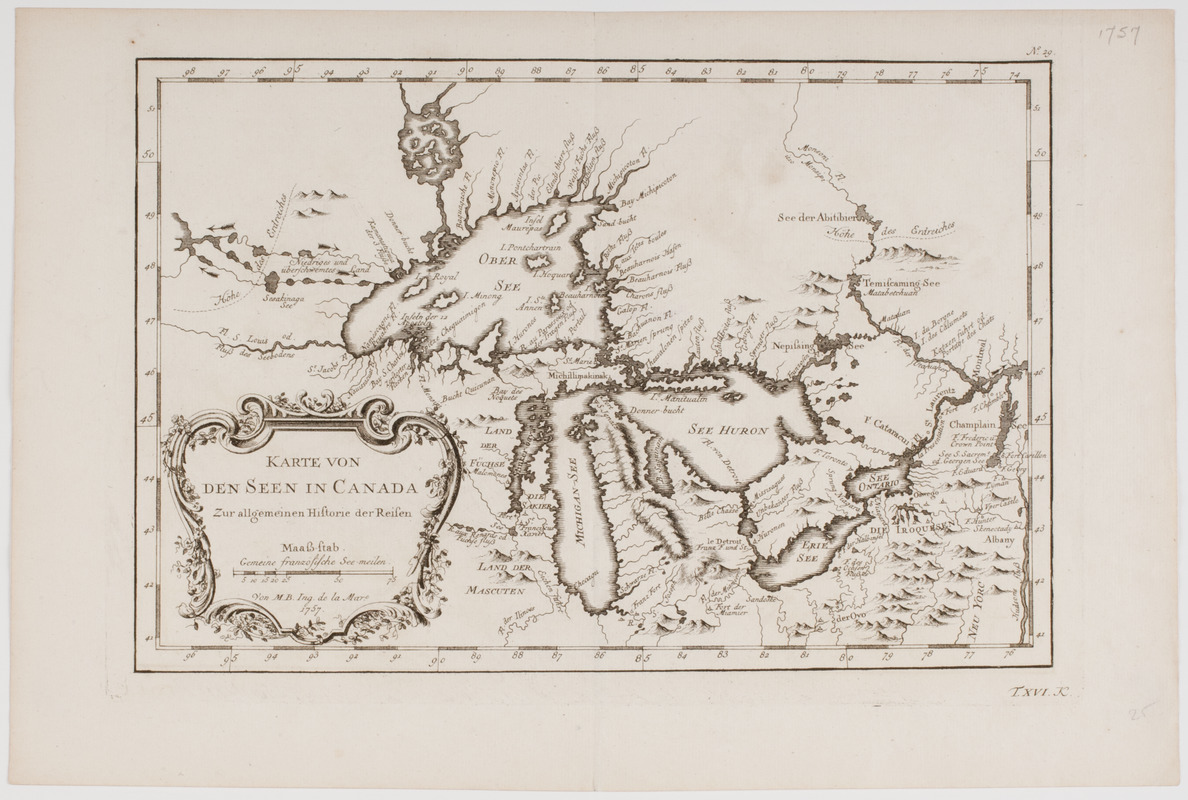
Karte von den seen in Canada
This map is also available in American Revolutionary Geographies Online (ARGO), a collections portal especially built for material relating to the American Revolutionary War Era. Visit ARGO to learn more about this item and explore the historical geography of North America in the late eighteenth century.
Item Information
- Title:
- Karte von den seen in Canada
- Title (uniform):
-
Allgemeine Historie des Reisen zu Wasser unde Lande
- Description:
-
Subject: Map of the Great Lakes in the United States and Canada.
- Creator:
- Bellin, Jacques Nicolas, 1703-1772
- Donor:
- Farwell, John Whittemore, 1843-1929
- Name on Item:
-
Von M.B. Ing de la Mare.
- Date:
-
1757
- Format:
-
Maps/Atlases
- Location:
- American Antiquarian Society
- Collection (local):
-
American Antiquarian Society Collection
- Subjects:
-
Great Lakes (North America)--Maps
United States--Maps
Canada--Maps
- Places:
-
Great Lakes
United States
Canada
- Extent:
- 1 map : engraving ; 19 x 29 cm., on sheet 25 x 37 cm.
- Terms of Use:
-
Public Domain/No known restrictions on use. Contact host institution to download image.
Contact host institution for more information.
- Publisher:
-
Leipzig :
[s.n.]
- Scale:
-
Scale [ca. 1:6,750,000]
- Language:
-
German
- Catalog Record:
-
http://catalog.mwa.org/vwebv/holdingsInfo?bibId=478841
- Notes:
-
Relief shown pictorially.
From Allgemeine Historie des Reisen zu Wasser unde Lande, Leipzig, 1758.
"No. 29. T. XVI. K."


