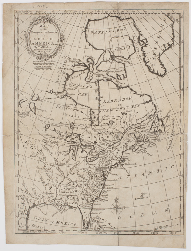
Map of the European settlements in North America
This map is also available in American Revolutionary Geographies Online (ARGO), a collections portal especially built for material relating to the American Revolutionary War Era. Visit ARGO to learn more about this item and explore the historical geography of North America in the late eighteenth century.
Item Information
- Title:
- Map of the European settlements in North America
- Description:
-
Subject: Map of the United States and Canada, stretching northward to the Arctic Circle.
- Creator:
- Kitchin, Thomas, 1719-1784
- Name on Item:
-
By Thos. Kitchin hydrographer to His Majesty.
- Date:
-
[1779]
- Format:
-
Maps/Atlases
- Location:
- American Antiquarian Society
- Collection (local):
-
American Antiquarian Society Collection
- Subjects:
-
North America--Maps
- Places:
-
North America (area)
- Extent:
- 1 map : engraving ; 32 x 24 cm., on sheet 35 x 27 cm.
- Terms of Use:
-
Public Domain/No known restrictions on use. Contact host institution to download image.
Contact host institution for more information.
- Publisher:
-
Edinburgh :
[s.n.]
- Scale:
-
Scale [ca. 1:25,000,000]
- Language:
-
English
- Catalog Record:
-
http://catalog.mwa.org/vwebv/holdingsInfo?bibId=488947
- Notes:
-
Prime meridian: London and Ferro.
Relief shown pictorially.
From Raynal, G.T.F., Philosophical and political history of the British settlements and trade in North America, Edinburgh, 1779.
- Notes (date):
-
This date is inferred.


