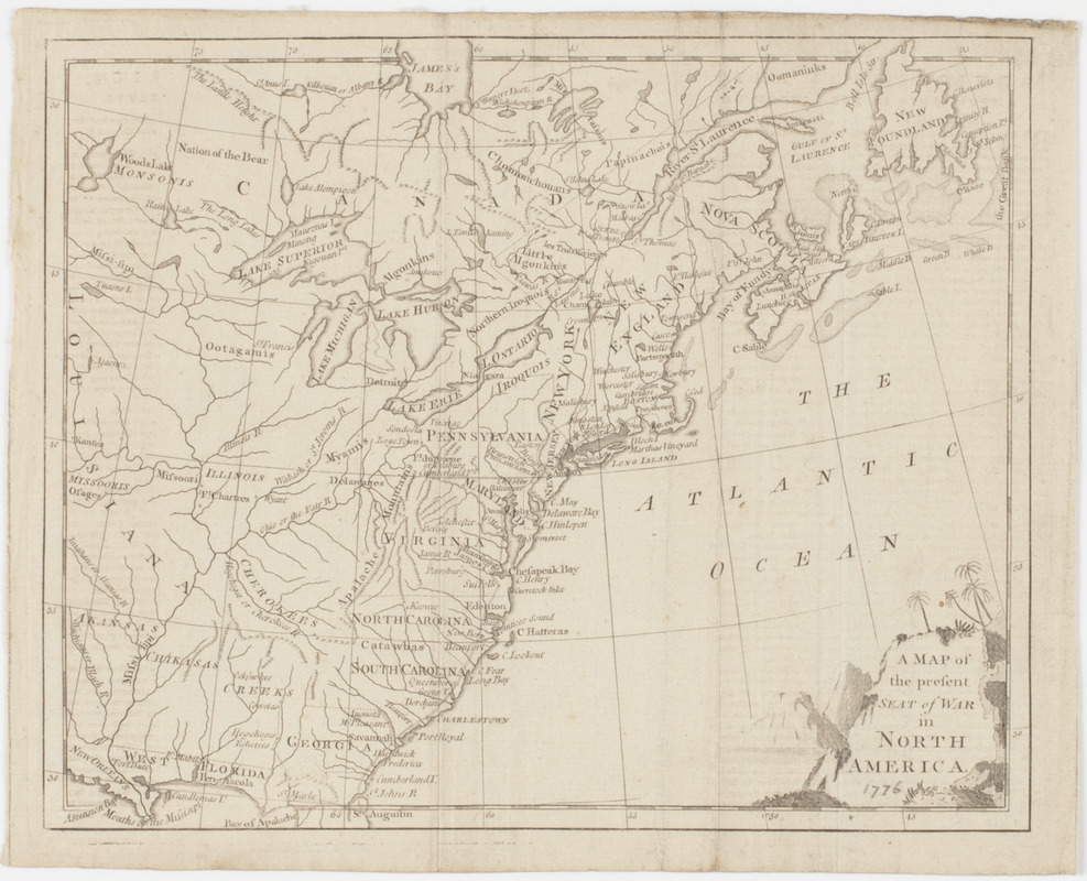
A Map of the present seat of war in North America
This map is also available in American Revolutionary Geographies Online (ARGO), a collections portal especially built for material relating to the American Revolutionary War Era. Visit ARGO to learn more about this item and explore the historical geography of North America in the late eighteenth century.
Item Information
- Title:
- A Map of the present seat of war in North America
- Title (uniform):
-
Westminster magazine
- Description:
-
Subject: Map of the United States and Canada from Newfoundland to the northern part of Florida, west into Louisiana.
- Date:
-
[1776]
- Format:
-
Maps/Atlases
- Location:
- American Antiquarian Society
- Collection (local):
-
American Antiquarian Society Collection
- Subjects:
-
United States--Maps
Canada--Maps
- Places:
-
United States
Canada
- Extent:
- 1 map : engraving ; 20 x 25 cm., on sheet 22 x 27 cm.
- Terms of Use:
-
Public Domain/No known restrictions on use. Contact host institution to download image.
Contact host institution for more information.
- Publisher:
-
London :
[s.n.]
- Scale:
-
Scale not given
- Language:
-
English
- Catalog Record:
-
http://catalog.mwa.org/vwebv/holdingsInfo?bibId=489793
- Notes:
-
Relief shown pictorially.
Appears in Westminster magazine, London, August, 1776.
- Notes (date):
-
This date is inferred.


