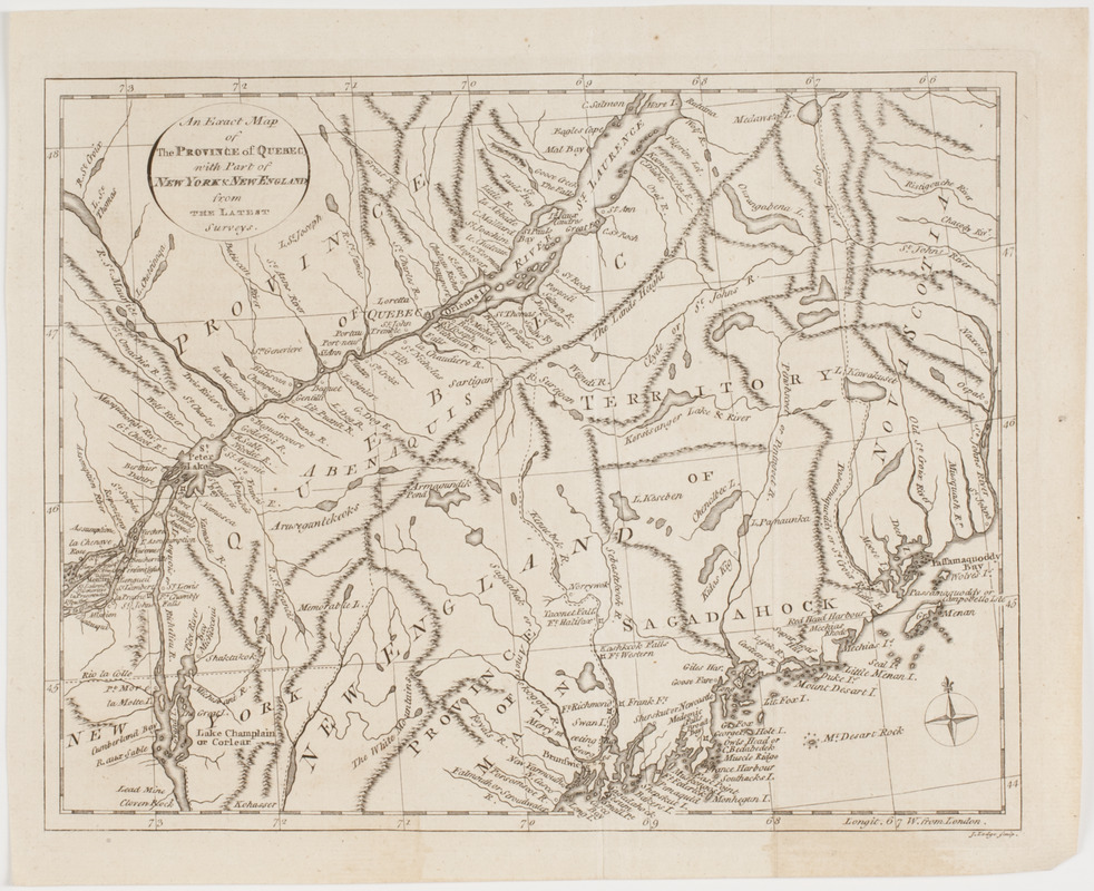
An Exact map of the province of Quebec with part of New York & New England from the latest surveys
This map is also available in American Revolutionary Geographies Online (ARGO), a collections portal especially built for material relating to the American Revolutionary War Era. Visit ARGO to learn more about this item and explore the historical geography of North America in the late eighteenth century.
Item Information
- Title:
- An Exact map of the province of Quebec with part of New York & New England from the latest surveys
- Description:
-
Subject: Map of the province of Quebec, with parts of the states of Maine (Massachusetts) and New York.
- Engraver:
- Lodge, John
- Name on Item:
-
J. Lodge sculp.
- Date:
-
[1800]
- Format:
-
Maps/Atlases
- Location:
- American Antiquarian Society
- Collection (local):
-
American Antiquarian Society Collection
- Subjects:
-
Québec (Province)--Maps
New England--Maps
- Places:
-
New England (area)
CanadaQuebec (province)
- Extent:
- 1 map : engraving ; 21 x 27 cm., on sheet 24 x 30 cm.
- Terms of Use:
-
Public Domain/No known restrictions on use. Contact host institution to download image.
Contact host institution for more information.
- Publisher:
-
London :
[s.n.]
- Scale:
-
Scale not given
- Language:
-
English
- Catalog Record:
-
http://catalog.mwa.org/vwebv/holdingsInfo?bibId=479001
- Notes:
-
Relief shown pictorially.
From Russell, W. The History of America, London, 1800.
- Notes (date):
-
This date is inferred.


