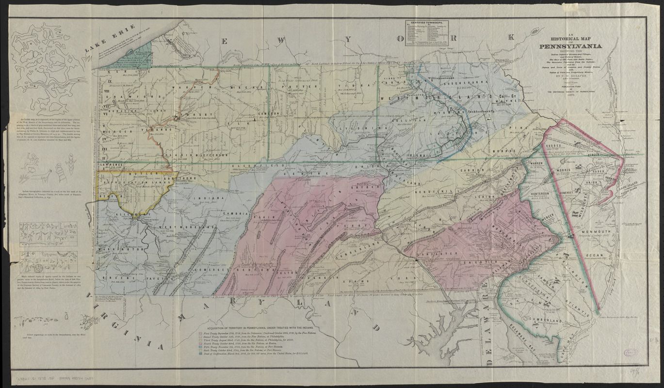
An historical map of Pennsylvania : showing the Indian names of streams and villages, and paths of travel : the sites of old forts and battle fields : the successive purchases from the Indians : and the names and dates of counties and county towns : with tables of forts and proprietary manors
Item Information
- Title:
- An historical map of Pennsylvania : showing the Indian names of streams and villages, and paths of travel : the sites of old forts and battle fields : the successive purchases from the Indians : and the names and dates of counties and county towns : with tables of forts and proprietary manors
- Cartographer:
- Sheafer, P. W. (Peter Wenrick), 1819-
- Publisher:
- Historical Society of Pennsylvania
- Lithographer:
- Lehman & Bolton
- Name on Item:
-
by P.W. Sheafer and others
- Date:
-
1875
- Format:
-
Maps/Atlases
- Location:
-
Boston Public Library
Norman B. Leventhal Map & Education Center - Collection (local):
-
Norman B. Leventhal Map & Education Center Collection
- Subjects:
-
Indians of North America--Pennsylvania--Maps
Indians of North America--Pennsylvania--Treaties--Maps
Fortification--Pennsylvania
Manors--Pennsylvania
Pennsylvania--Maps
Pennsylvania--Historical geography--Maps
New Jersey--Maps
New Jersey--Historical geography--Maps
- Places:
-
Pennsylvania
New Jersey
- Extent:
- 1 map : color ; 57 x 97 cm + 1 text (26 pages ; 25 cm)
- Terms of Use:
-
No known copyright restrictions.
No known restrictions on use.
- Publisher:
-
Philadelphia :
Publication Fund of the Historical Society of Pennsylvania
- Scale:
-
Scale approximately 1:700,000
- Language:
-
English
- Notes:
-
Also covers New Jersey.
Relief shown by hachures.
Includes illustrations of Indian rock carvings and tables.
Accompanied by explanatory text with historical table, list of forts, and list of manors.
- Identifier:
-
06_01_016398
- Call #:
-
G3821.S1 1875 .S5
- Barcode:
-
39999085947487


