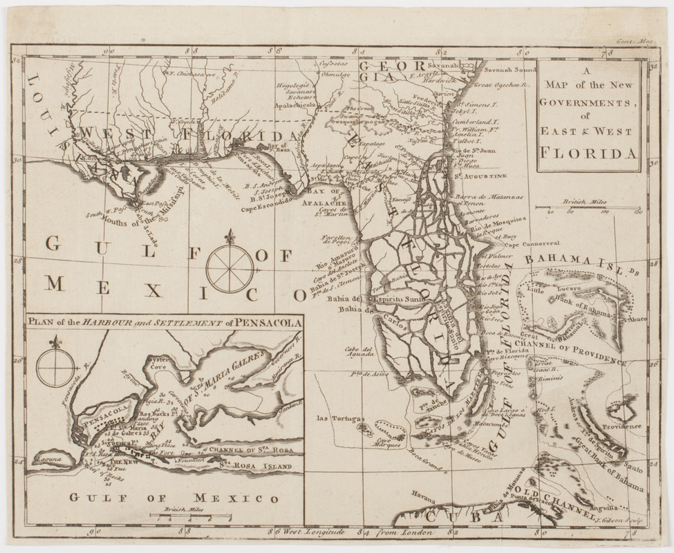
A Map of the new governments, of East & West Florida
This map is also available in American Revolutionary Geographies Online (ARGO), a collections portal especially built for material relating to the American Revolutionary War Era. Visit ARGO to learn more about this item and explore the historical geography of North America in the late eighteenth century.
Item Information
- Title:
- A Map of the new governments, of East & West Florida
- Title (uniform):
-
Gentleman's magazine (London, England)
- Description:
-
Subject: Map of the state of Florida showing the East Florida penninsula as a set of islands. Also shows the Bermuda islands as being just off the coast of Florida. Includes inset of the harbor of Pensacola in West Florida.
- Engraver:
- Gibson, J. (John), active 1750-1792
- Name on Item:
-
J. Gibson sculp.
- Date:
-
[1763]
- Format:
-
Maps/Atlases
- Location:
- American Antiquarian Society
- Collection (local):
-
American Antiquarian Society Collection
- Subjects:
-
Pensacola (Fla.)--Maps
Florida--Maps
- Places:
-
Escambia (county)Pensacola
- Extent:
- 1 map : engraving ; 20 x 26 cm., on sheet 21 x 26 cm.
- Terms of Use:
-
Public Domain/No known restrictions on use. Contact host institution to download image.
Contact host institution for more information.
- Publisher:
-
London :
[s.n.]
- Scale:
-
Scale [ca. 1:6,336,000]
- Language:
-
English
- Catalog Record:
-
http://catalog.mwa.org/vwebv/holdingsInfo?bibId=486034
- Notes:
-
Relief shown by hachures.
From the November, 1763 issue of Gentleman's magazine.
"Gent. mag."
Inset: Plan of the harbour and settlement of Pensacola."
- Notes (date):
-
This date is inferred.


