Map of the province of West Florida
This map is also available in American Revolutionary Geographies Online (ARGO), a collections portal especially built for material relating to the American Revolutionary War Era. Visit ARGO to learn more about this item and explore the historical geography of North America in the late eighteenth century.
Item Information
- Title:
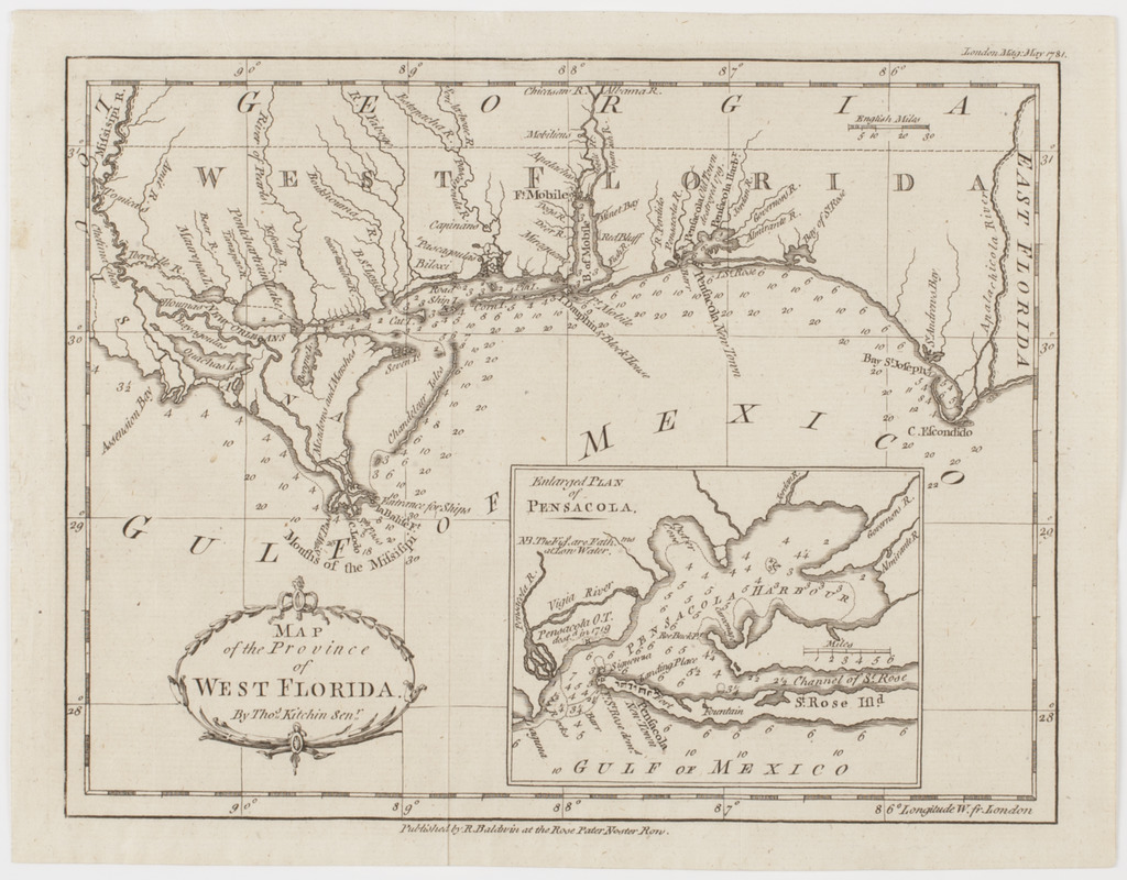
- Map of the province of West Florida
- Title (uniform):
-
London magazine
- Description:
-
Subject: Map of the panhandle of Florida, reaching from the Mississippi River to the Apalachicola River. Includes an inset of Pensacola harbor.
- Creator:
- Kitchin, Thomas, 1719-1784
- Publisher:
- Baldwin, R. (Robert), 1737-1810
- Name on Item:
-
By Thos. Kitchin Senr.
- Date:
-
[1781]
- Format:
-
Maps/Atlases
- Location:
- American Antiquarian Society
- Collection (local):
-
American Antiquarian Society Collection
- Subjects:
-
Florida--Maps
Pensacola (Fla.)--Maps
- Places:
-
FloridaEscambia (county)Pensacola
- Extent:
- 1 map : engraving ; 19 x 24 cm., on sheet 21 x 27 cm.
- Terms of Use:
-
Public Domain/No known restrictions on use. Contact host institution to download image.
Contact host institution for more information.
- Publisher:
-
[London] :
Published by R. Baldwin at the Rose Pater Noster Row.
- Scale:
-
Scale [ca. 1:2,534,000]
- Language:
-
English
- Catalog Record:
-
http://catalog.mwa.org/vwebv/holdingsInfo?bibId=486371
- Notes:
-
Depths shown by soundings.
"London mag. May 1781."
Inset: Enlarged plan of Pensacola.
- Notes (date):
-
This date is inferred.


