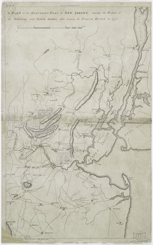
A plan of the northern part of New Jersey : shewing the positions of the American and British armies after crossing the North River in 1776
This map is also available in American Revolutionary Geographies Online (ARGO), a collections portal especially built for material relating to the American Revolutionary War Era. Visit ARGO to learn more about this item and explore the historical geography of North America in the late eighteenth century.
Item Information
- Title:
- A plan of the northern part of New Jersey : shewing the positions of the American and British armies after crossing the North River in 1776
- Creator:
- Lewis, Samuel, 1753 or 1754-1822
- Contributor:
- Shallus, Francis
- Contributor:
- Wayne, Caleb Parry, 1776-1849
- Name on Item:
-
drawn by S. Lewis from surveys by order of Gen. Washington ; engrav'd by Fs. Shallus.
- Date:
-
[1807]
- Format:
-
Maps/Atlases
- Location:
- New York Public Library
- Collection (local):
-
Maps of North America
- Subjects:
-
New Jersey--History--Revolution, 1775-1783--Maps
New Jersey--Maps
- Places:
-
New Jersey
- Extent:
- 1 map ; 41 x 26 cm
- Terms of Use:
-
No known copyright restrictions.
This work is licensed for use under a Creative Commons Attribution Non-Commercial Share Alike License (CC BY-NC-SA).

- Publisher:
-
Philadelphia :
Published by C.P. Wayne
- Scale:
-
Scale [ca. 1:290,000]
- Language:
-
English
- Catalog Record:
-
https://digitalcollections.nypl.org/items/510d47db-c29d-a3d9-e040-e00a18064a99
- Notes:
-
Relief shown by hachures.
Covers New Jersey as far west and south as Trenton.
In upper margin: Plate IV. Engraved for Washington's Life.
From John Marshall's The life of George Washington. Maps and subscribers' names. 1807.
- Notes (date):
-
This date is inferred.

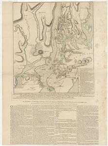
![[Plan of engagement with British ships near Red Bank, New Jersey, October 22 and 23, 1777]](https://bpldcassets.blob.core.windows.net/derivatives/images/commonwealth:9s161d76t/image_thumbnail_300.jpg)