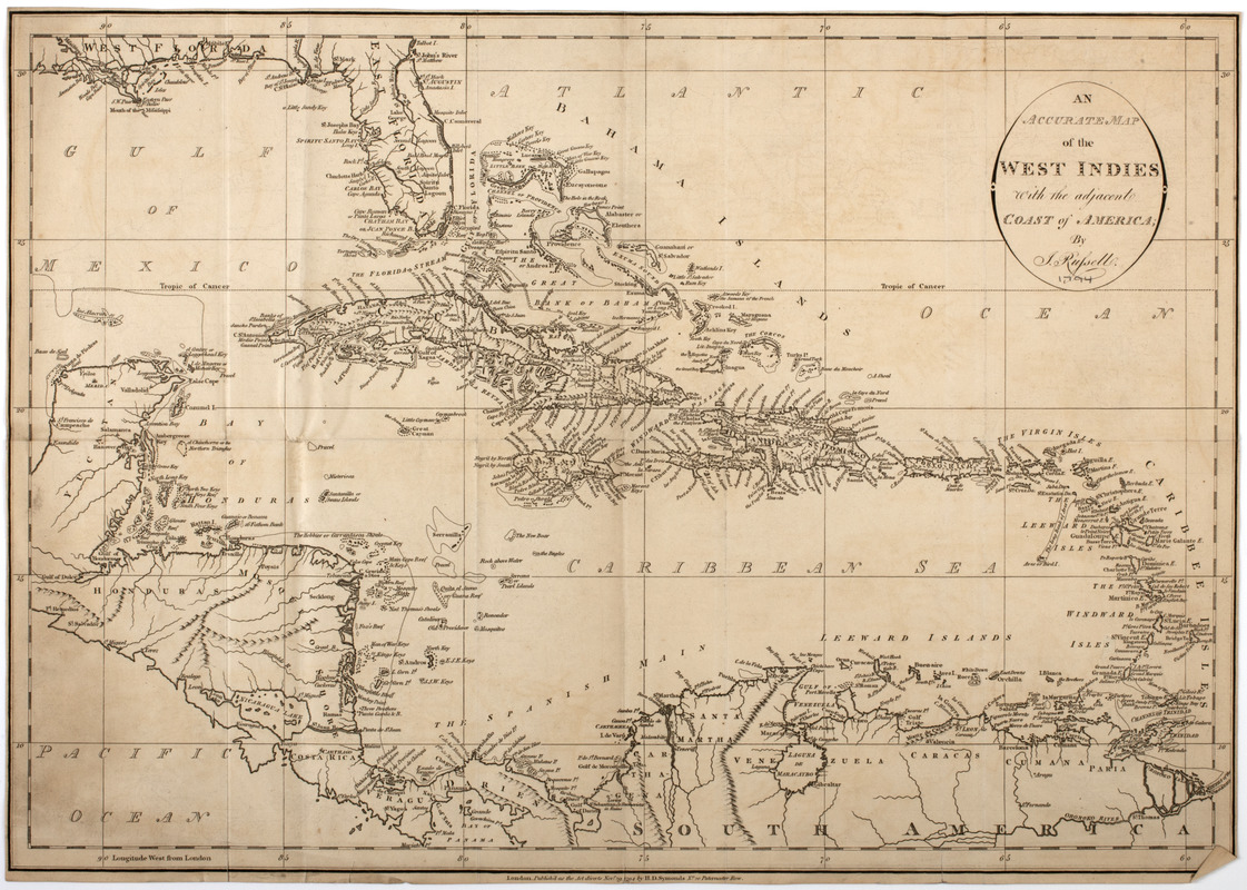
An accurate map of the West Indies with the adjacent coast of America
This map is also available in American Revolutionary Geographies Online (ARGO), a collections portal especially built for material relating to the American Revolutionary War Era. Visit ARGO to learn more about this item and explore the historical geography of North America in the late eighteenth century.
Item Information
- Title:
- An accurate map of the West Indies with the adjacent coast of America
- Description:
-
Subject: Map of the West Indies, including parts of Florida, Central America, and South America.
- Creator:
- Russell, J.
- Publisher:
- Symonds, H. D. (Henry Delahoy)
- Name on Item:
-
by J. Russell.
- Date:
-
[1794]
- Format:
-
Maps/Atlases
- Location:
- American Antiquarian Society
- Collection (local):
-
American Antiquarian Society Collection
- Subjects:
-
West Indies--Maps
- Places:
-
West Indies
- Extent:
- 1 map : engraving ; 35 x 50 cm.
- Terms of Use:
-
Public Domain/No known restrictions on use. Contact host institution to download image.
Contact host institution for more information.
- Publisher:
-
London :
Publish'd as the Act directs Novr. 29 1794 by H.D. Symonds no. 20 Paternoster Row.
- Scale:
-
Scale not given
- Language:
-
English
- Catalog Record:
-
http://catalog.mwa.org/vwebv/holdingsInfo?bibId=483197
- Notes:
-
Relief shown pictorially.
- Notes (date):
-
This date is inferred.


