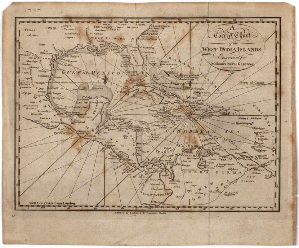
A Correct chart of the West India islands : engraved for Malham's naval gazetteer
This map is also available in American Revolutionary Geographies Online (ARGO), a collections portal especially built for material relating to the American Revolutionary War Era. Visit ARGO to learn more about this item and explore the historical geography of North America in the late eighteenth century.
Item Information
- Title:
- A Correct chart of the West India islands : engraved for Malham's naval gazetteer
- Description:
-
Subject: Map of the West Indies with Texas and Florida shown, as well as part of Central and South America.
- Engraver:
- Hill, Samuel, approximately 1766-1804
- Former owner:
- New England Historic Genealogical Society
- Publisher:
- W. Spotswood and J. Nancrede (Firm)
- Name on Item:
-
S.H. sc.
- Date:
-
[1797]
- Format:
-
Maps/Atlases
- Location:
- American Antiquarian Society
- Collection (local):
-
American Antiquarian Society Collection
- Subjects:
-
West Indies--Maps
- Places:
-
West Indies
- Extent:
- 1 map : engraving ; 18 x 24 cm., on sheet 22 x 26 cm.
- Terms of Use:
-
Public Domain/No known restrictions on use. Contact host institution to download image.
Contact host institution for more information.
- Publisher:
-
[Boston] :
Published by Spotswood & Nancrede, Boston.
- Scale:
-
Scale not given
- Language:
-
English
- Catalog Record:
-
http://catalog.mwa.org/vwebv/holdingsInfo?bibId=483202
- Notes:
-
From Malham, J. Naval gazetteer, Boston, 1797.
- Notes (date):
-
This date is inferred.


