Map of the commonwealth of Massachusetts exclusive of the district of Maine : compiled pursuant to an act of the General Court from actual surveys of the several towns, &c. Taken by their order
This map is also available in American Revolutionary Geographies Online (ARGO), a collections portal especially built for material relating to the American Revolutionary War Era. Visit ARGO to learn more about this item and explore the historical geography of North America in the late eighteenth century.
Item Information
- Title:
- Map of the commonwealth of Massachusetts exclusive of the district of Maine : compiled pursuant to an act of the General Court from actual surveys of the several towns, &c. Taken by their order
- Description:
-
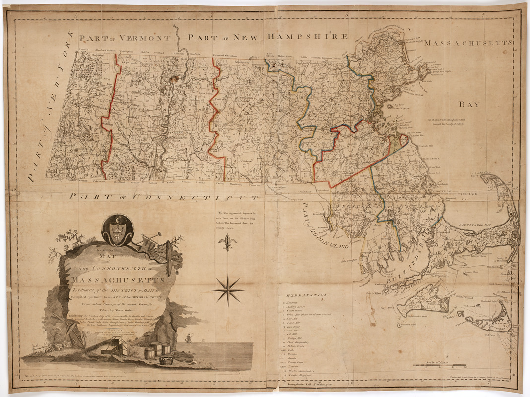
Subject: Map of Massachusetts showing the state divided into counties and towns. Shows the distance from each town to Boston and it's county shire town. Cartouche at lower left includes the seal of the state of Massachusetts.
- Creator:
- Carleton, Osgood, 1742-1816
- Publisher:
- Carleton, Osgood, 1742-1816
- Publisher:
- Norman, John, 1748?-1817
- Publisher:
- Norman, William, -1807
- Name on Item:
-
By Osgood Carleton.
- Date:
-
[1795?]
- Format:
-
Maps/Atlases
- Location:
- American Antiquarian Society
- Collection (local):
-
American Antiquarian Society Collection
- Subjects:
-
Massachusetts--Maps
Massachusetts--Seal
- Places:
-
Massachusetts
- Extent:
- 1 map on 4 sheets : engraving, hand colored ; 90 x 120 cm., on sheets 42 x 62 cm. or smaller
- Terms of Use:
-
Public Domain/No known restrictions on use. Contact host institution to download image.
Contact host institution for more information.
- Publisher:
-
Boston :
Published and sold by O. Carleton and I. Norman sold also by W. Norman no. 75 Newbury Street.
- Scale:
-
Scale [ca. 1:281,600]
- Language:
-
English
- Catalog Record:
-
http://catalog.mwa.org/vwebv/holdingsInfo?bibId=490326
- Notes:
-
Prime meridian: Washington, D.C.
Relief shown pictorially.

![[Map of the towns of Western Massachusetts]](https://bpldcassets.blob.core.windows.net/derivatives/images/commonwealth:6108vv02d/image_thumbnail_300.jpg)


