Toggle navigation
LMEC Home
Exhibitions
Georeferencing
Tools for Teachers
Collections
My Favorites
Sign Up / Log In
Search
Search the map portal
Map Collection
Map Collection
Map Sets
Search
Search
Search for
Search In
All Fields
Creator
Title
Subject
Place
Search All Digital Collections
Advanced Search
8208 Results
My Search
Start Over
More Like
commonwealth:9s161g279
Remove constraint More Like: commonwealth:9s161g279
Filter your Search
Place
North and Central America
4,957
United States
3,764
Suffolk (county)
1,026
Boston
999
Europe
963
Canada
433
Massachusetts
294
France
269
more
Place
»
Topic
Boston (Mass.)--Maps
574
United States--Maps
270
Real property--Massachusetts--Boston--Maps
174
Massachusetts--Maps
160
Landowners--Massachusetts--Boston--Maps
132
North America--Maps--Early works to 1800
105
New England--Maps
99
Europe--Maps
78
more
Topic
»
Date
Date range begin
–
Date range end
Current results range from
1482
to
2023
View distribution
Creator
United States. Hydrographic Office
357
O.H. Bailey & Co
148
Des Barres, Joseph F. W. (Joseph Frederick Wallet), 1722-1824
123
United States. Post Office Dept
120
Ptolemy, 2nd cent
100
Walling, Henry Francis, 1825-1888
94
Jefferys, Thomas, -1771
87
Geological Survey (U.S.)
82
more
Creator
»
Format
Maps/Atlases
8,149
Manuscripts
218
Prints
51
Books
36
Objects/Artifacts
10
Drawings/Illustrations
8
Posters
4
Georeferenced
Yes
871
No
7,337
Collection
Norman B. Leventhal Map Center Collection
8,170
Boston and New England Maps
2,184
Urban Maps
1,925
Maritime Charts and Atlases
753
American Revolutionary War-Era Maps
651
Boston Redevelopment Authority Collection
86
New York Public Library Collection
19
Richard H. Brown Revolutionary War Map Collection at Mount Vernon
11
more
Collection
»
Available to use
No known restrictions
8,022
Creative Commons license
86
Search Constraints
Sort by relevance
relevance
title
date (asc)
date (desc)
Number of results to display per page
100 per page
10
per page
20
per page
50
per page
100
per page
View results as:
grid view
map view
Search Results
1.
New Engelland, New York, New Yersey und Pensilvania
2.
Pensylvania Nova Jersey et Nova York cum Regionibus ad Fluvium Delaware in America sitis
3.
A map of the provinces of New-York and New Jersey, with a part of Pennsylvania and the Province of Quebec
4.
Pas caert van Nieu Nederland, Virginia en Nieu Engelant
5.
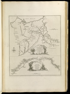
La Pensilvania, la Nuova York, il Jersey Settentrio[na]le : con la parte occidentale del Connecticut, Massachusset-s-bay e...
6.
A map of the Province of New York, with part of Pensilvania, and New England : from an actual survey by Captain Montresor,...
7.
A map of the Province of New York, with part of Pensilvania, and New England : from an actual survey by Captain Montresor,...
8.
Mappa geographica Provinciæ Nova Eboraci ab Anglis New-York : dictæ ex ampliori delineatione ad exactas dimensiones concinnata...
9.
Carte de la Pensylvanie et du Nouveau Jersey
10.
[Environs of Philadelphia]
11.
A map exhibiting a general view of the roads and inland navigation of Pennsylvania, and part of the adjacent states :...
12.
A map of Pennsylvania exhibiting not only the improved parts of that Province, but also its extensive frontiers : laid down...
13.
A map of the country between Will's Creek & Monongahela River shewing the rout and encampments of the English army in 1755
14.
A map of the country on the Ohio and Muskingum Rivers : shewing the situation of the Indian towns with respect to the army...
15.
A mapp of ye improved part of Pensilvania in America, divided into countyes, townships, and lotts
16.
A new and accurate map of the province of Pennsylvania in North America, from the best authorities
17.
A new map of Virginia, Mary-land and the improved parts of Penn-sylvania & New Jersey
18.
A plan of the city and environs of Philadelphia
19.
The State of Pennsylvania
20.
To the Honourable Thomas Penn and Richard Penn, Esqrs., true & absolute proprietaries & Governours of the Province of...
21.
An Accurate map of New York in North America, from a late survey
22.
Carte de la Nouvelle York, y-compris les terres cédées du N. Hamp-Shire, sous le nom d'etat de Vermont
23.
A chorographical map of the Province of New-York in North America, divided into counties, manors, patents and townships :...
24.
A chorographical map of the Province of New-York in North America, divided into counties, manors, patents and townships :...
25.
A map of the inhabited part of Canada from the French surveys : with the frontiers of New York and New England from the large...
26.
The southern part of the Province of New York : with part of the adjoining colonies
27.
Carte du théatre de la guerre entre les Anglais et les Américains
28.
Carte du théatre de la guerre entre les Anglais et les Américains
29.
A general map of the middle British colonies in America : viz. Virginia, Maryland, Delaware, Pensilvania, New-Jersey, New-York,...
30.
A general map of the middle British colonies in America, viz. Virginia, Maryland, Delaware, Pensilvania, New-Jersey, New York,...
31.
[Globe gore featuring North American coastline]
32.
A map of the middle British colonies in North America : first published by Mr. Lewis Evans, of Philadelphia, in 1755; and since...
33.
A map of the middle British colonies in North America : first published by Mr. Lewis Evans, of Philadelphia, in 1755; and since...
34.
A New and correct map of the British colonies in North America comprehending eastern Canada with the province of Quebec, New...
35.
Noui Belgii Nouaeque Angliae nec non partis Virginiae tabula
36.
Nova Anglia Septentrionali Americae implantata Anglorumque coloniis florentissima geographicè exhibita
37.
Novi Belgii Novaeqve Angliae nec non partis Virginiae Tabula
38.
The provinces of New York and New Jersey : with part of Pensilvania, and the Province of Quebec
39.
[A map of part of Pennsylvania & Maryland intended to shew, at one view, the several places proposed for opening a...
40.
Carte des environs du Fort Pitt et de la nouvelle province Indiana : dediée a M. Franklin
41.
An exact map of New Jersey, Pensylvania [sic], New York, Maryland & Virginia, from the latest surveys
42.
A map of the country between Will's Creek & Monongahela River shewing the rout and encampments of the English army in 1755
43.
A map of the state of Pennsylvania
44.
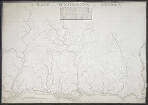
A MAPP OF PENSYLVANIA IN AMERICA
45.
A New and accurate map of Virginia : and part of Maryland and Pennsylvania
46.
PLAN OF THE PENINSULA OF CHESOPEAK BAY
47.
Seat of war in the environs of Philadeliphia
48.
Seat of war in the environs of Philadeliphia
49.
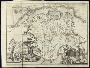
A topographical plan of that part of the Indian-country through which Colonel Bouquet marched in the year, 1764
50.
A chorographical map of the northern department of North-America
51.
A chorographical map of the Province of New-York in North America, divided into counties, manors, patents and townships :...
52.
Lauff des flusses St. Laurentzi von Quebec bis an den See Ontario : 2. bladt
53.
A map of New England and New York
54.
A map of the eastern part of the province of New York with part of New Jersey, & c
55.
A map of the eastern part of the province of New York with part of New Jersey, & c
56.
A map of the inhabited part of Canada from the French surveys : with the frontiers of New York and New England from the large...
57.
New England and New York
58.
Noua Anglia, Nouum Belgium, et Virginia
59.
Nouvelle Angleterre et Nouvel York
60.
The provinces of New York, and New Jersey; with part of Pensilvania, and the governments of Trois Rivières, and Montreal
61.
The state of New York, compiled from the most authentic information, 1796
62.
Carta della Nuova Inghilterra, Nuova Yorc, e Pensilvania
63.
Carte de la Nouvelle Angleterre, New York, Pensilvanie et Nouveau Jersay suivant les cartes angloises
64.
Carte de la partie nord, des Etats Unis, de l'Amérique Septentrionale
65.
Carte des Etats-unis : provinces septentrionales
66.
Carte d'une partie du Nord Amerique dans la quelle se trouvent les isles et les provinces suivantes : l'Isle de la Terre-Neuve...
67.
Carte reduite des costes orientales de l'Amerique septentrionale : 1re. feuille contenant L'Isle Royale, L'Accadie, La Baye...
68.
A chart of the sea coast of New Foundland, New Scotland, New England, New York, New Jersey, with Virginia and Maryland
69.
A general map of the middle British colonies in America : Viz. Virginia, Maryland, Delaware, Pensilvania, New-Jersey, New-York,...
70.
A general map of the middle British colonies, in America : viz Virginia, Màriland, Dèlaware, Pensilvania, New-Jersey, New-York,...
71.
A large draught of New England, New York and Long Island
72.
Map of the middle states of America : drawn from the latest and best authorities
73.
Map of the northern provinces of the United States
74.
A map of the Province of New-York : reduc'd from the large drawing of that province, compiled from actual surveys by order of...
75.
A new and accurate map of New Jersey, Pensilvania, New York and New England : with the adjacent countries. Drawn from surveys,...
76.
A new map of New England, New York, New Iarsey, Pensilvania, Maryland and Virginia
77.
Nova Belgica et Anglia Nova
78.
Part of North America : comprehending the course of Ohio, New England, New York, New Jersey, Pennsylvania, Maryland, Virginia,...
79.
Partie occidentale de la Virginie, Pensylvanie, Maryland, et Caroline septle. la Rivière d'Ohio, et toutes celles qui s'y...
80.
Pas-caert van Nieu Nederland, Virginia, Nieu Engeland als mede Penn-silvania, met de stad Philadelfia van Baston tot Carrik = a...
81.
The 100th anniversary map of Abraham Lincoln's visit to Massachusetts, September 11-23, 1848
82.
1630 shoreline
83.
1879. Progress map of the U.S. Geographical Surveys west of the 100th Meridian : prepared under the direction of 1st Lieut....
84.
1903 Map of Salem and surrounding places
85.
19th annual convention of the National Association of Real Estate Boards : at Tulsa, June 7 to June 11 in 1926
86.
2005 significant U.S. hurricane strikes
87.
The 2100 project : an atlas for the Green New Deal
88.
227 Harzgerode
89.
305 Glatz
90.
38,000,000 escaped -- 10,000,000 died
91.
4 Kinten
92.
660 Wakulah St., Roxbury
93.
[A chart of Boston Bay and vicinity]
94.
[A chart of New York Island & North River : East River, passage through Hell Gate, Flushing Bay, Hampstead Bay, Oyster,...
95.
The A.A.A. key road map of continental Europe
96.
Aaron Bohrod's America, its history
97.
ABC pathfinder railway guide map : eastern division
98.
Abolition of Slavery, 1863
99.
Aboriginal map of North America, denoting the boundaries and the locations of various Indian tribes
100.
Acapulco, México
‹ Prev
Next ›
1
2
3
4
5
…
82
83


![La Pensilvania, la Nuova York, il Jersey Settentrio[na]le](https://bpldcassets.blob.core.windows.net/derivatives/images/commonwealth:z603vq53g/image_thumbnail_300.jpg)


![[Environs of Philadelphia]](https://bpldcassets.blob.core.windows.net/derivatives/images/commonwealth:7h149x76d/image_thumbnail_300.jpg)


![[Globe gore featuring North American coastline]](https://bpldcassets.blob.core.windows.net/derivatives/images/commonwealth:qb98n804g/image_thumbnail_300.jpg)


![[A map of part of Pennsylvania & Maryland intended to shew, at one view, the several places proposed for opening a communication between the waters of the Delaware & Chesopeak Bays]](https://bpldcassets.blob.core.windows.net/derivatives/images/commonwealth:z603vt12v/image_thumbnail_300.jpg)

![An exact map of New Jersey, Pensylvania [sic], New York, Maryland & Virginia, from the latest surveys](https://bpldcassets.blob.core.windows.net/derivatives/images/commonwealth:z603vp67m/image_thumbnail_300.jpg)


![[A chart of Boston Bay and vicinity]](https://bpldcassets.blob.core.windows.net/derivatives/images/commonwealth:cj82m2976/image_thumbnail_300.jpg)


