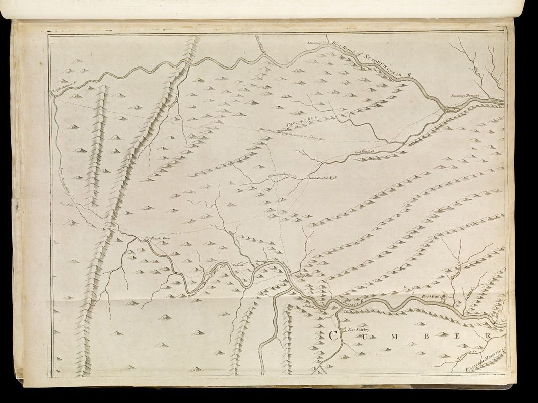
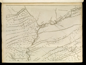
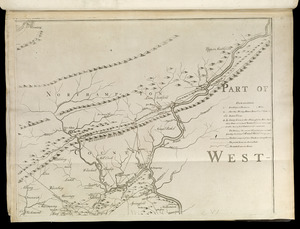
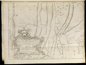
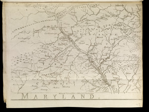
To the Honourable Thomas Penn and Richard Penn, Esqrs., true & absolute proprietaries & Governours of the Province of Pennsylvania & counties of New-Castle, Kent & Sussex on Delaware this map of the improved part of the Province of Pennsylvania

This map is also available in American Revolutionary Geographies Online (ARGO), a collections portal especially built for material relating to the American Revolutionary War Era. Visit ARGO to learn more about this item and explore the historical geography of North America in the late eighteenth century.
Item Information
- Title:
- To the Honourable Thomas Penn and Richard Penn, Esqrs., true & absolute proprietaries & Governours of the Province of Pennsylvania & counties of New-Castle, Kent & Sussex on Delaware this map of the improved part of the Province of Pennsylvania
- Title (alt.):
-
Map of the improved part of the Province of Pennsylvania
- Cartographer:
- Scull, Nicholas, 1686?-1761?
- Engraver:
- Turner, James, -1759
- Printer:
- Davis, John (Printer)
- Publisher:
- Sayer, Robert, 1725-1794
- Publisher:
- Jefferys, Thomas, -1771
- Name on Item:
-
is humbly dedicated by Nicholas Scull ; engraved by Ja. Turner and printed by John Davis for the author
- Date:
-
[1768]
- Format:
-
Maps/Atlases
- Location:
-
Boston Public Library
Norman B. Leventhal Map & Education Center - Collection (local):
-
Norman B. Leventhal Map & Education Center Collection
- Subjects:
-
Indians of North America--Pennsylvania--Maps--Early works to 1800
Counties--Pennsylvania--Maps--Early works to 1800
Pennsylvania--Maps--Early works to 1800
- Places:
-
Pennsylvania
- Extent:
- 1 map on 6 sheets ; 75 x 151 cm., on sheets 54 x 42 cm.
- Terms of Use:
-
No known copyright restrictions.
No known restrictions on use.
- Publisher:
-
London :
Printed for Robert Sayer, ... and Thomas Jefferys
- Scale:
-
Scale [ca. 1:245,000]
- Language:
-
English
- Notes:
-
Relief shown pictorially.
Shows county boundaries.
Retains imprint of original issue: Philadelphia : Sold by the author, Nicholas Scull, 1759.
Appears in Jefferys' General topography of North America and the West Indies. London: Printed for Robert Sayer, ... and Thomas Jefferys, 1768.
- Notes (date):
-
This date is inferred.
- Notes (citation):
-
LC Maps of North America, 1750-1789, 1294
Phillips, 1196
- Identifier:
-
4000137_0050r
4000137_0051r
4000137_0052r
4000137_0053r
4000137_0054r
4000137_0055r
- Call #:
-
G1105 .J4 1768
- Barcode:
-
30000003254603

![[Environs of Philadelphia]](https://bpldcassets.blob.core.windows.net/derivatives/images/commonwealth:7h149x76d/image_thumbnail_300.jpg)


