A chorographical map of the Province of New-York in North America, divided into counties, manors, patents and townships : exhibiting likewise all the private grants of land made and located in that Province
Item Information
- Title:
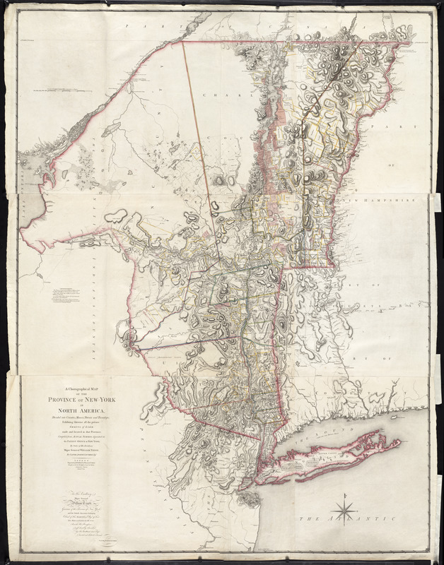
- A chorographical map of the Province of New-York in North America, divided into counties, manors, patents and townships : exhibiting likewise all the private grants of land made and located in that Province
- Creator:
- Sauthier, Claude Joseph
- Contributor:
- Faden, William, 1749-1836
- Name on Item:
-
compiled from actual surveys deposited in the Patent Office at New York, by order of His Excellency Major General William Tryon, by Claude Joseph Sauthier ; engraved and published by William Faden
- Date:
-
1779
- Format:
-
Maps/Atlases
- Location:
-
Boston Public Library
Norman B. Leventhal Map & Education Center - Collection (local):
-
Norman B. Leventhal Map & Education Center Collection
- Subjects:
-
Real property--New York (State)--Maps--Early works to 1800
New York (State)--Maps--Early works to 1800
New York (State)--Administrative and political divisions--Maps--Early works to 1800
- Places:
-
New York
- Extent:
- 1 map on 3 sheets : col. ; 186 x 138 cm, sheets 62 x 41 cm.
- Terms of Use:
-
No known copyright restrictions.
No known restrictions on use.
- Publisher:
-
London :
Wm. Faden
- Scale:
-
Scale [ca. 1:326,000]
- Language:
-
English
- Notes:
-
Relief shown by hachures. Depths shown by form lines.
Hand colored.
Prime meridian: London.
Inscribed: To His Excellency Major General William Tryon ...
"Advertisement. The tracts of land coloured red, are military grants ... Those with a green edge are manors, and those coloured yellow are townships ... "
Appears in Thomas Jefferys' The American atlas. 1776.
Cataloging, conservation, and digitization made possible in part by The National Endowment for the Humanities: Exploring the human endeavor.
- Identifier:
-
06_01_009623
- Barcode:
-
30000002803691


