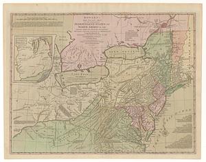
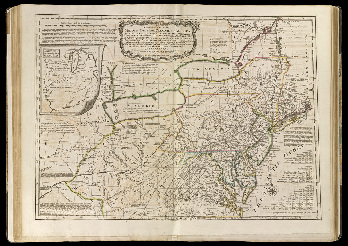
A general map of the middle British colonies in America : viz. Virginia, Maryland, Delaware, Pensilvania, New-Jersey, New-York, Connecticut, and Rhode-Island: of Aquanishuonîgy the country of the Confederate Indians comprehending Aquanishuonigy proper, their places of residence, Ohio and Thuchsochruntie their deer hunting countries, Couchsachrage and Skaniadarade their beaver hunting countries, of the Lakes Erie, Ontario, and Champlain, exhibiting the antient and present seats of the Indian nations
Item Information
- Title:
- A general map of the middle British colonies in America : viz. Virginia, Maryland, Delaware, Pensilvania, New-Jersey, New-York, Connecticut, and Rhode-Island: of Aquanishuonîgy the country of the Confederate Indians comprehending Aquanishuonigy proper, their places of residence, Ohio and Thuchsochruntie their deer hunting countries, Couchsachrage and Skaniadarade their beaver hunting countries, of the Lakes Erie, Ontario, and Champlain, exhibiting the antient and present seats of the Indian nations
- Creator:
- Jefferys, Thomas, -1771
- Contributor:
- Evans, Lewis, 1700?-1756
- Contributor:
- Sayer, Robert, 1725-1794
- Name on Item:
-
published by Lewis Evans at Philadelphia, corrected and improved with the addition of the line of forts on the back settlements ; by Thos. Jefferys
- Date:
-
[1768]
- Format:
-
Maps/Atlases
- Location:
-
Boston Public Library
Norman B. Leventhal Map & Education Center - Collection (local):
-
Norman B. Leventhal Map & Education Center Collection
- Subjects:
-
Indians of North America--Maps--Early works to 1800
Northeastern States--Maps--Early works to 1800
- Places:
-
Northeastern United States (area)
- Extent:
- 1 map : hand col. ; 49 x 67 cm.
- Terms of Use:
-
No known copyright restrictions.
No known restrictions on use.
- Publisher:
-
[London] :
Sold by R. Sayer in Fleet-Street & T. Jefferys, Charing Cross
- Scale:
-
Scale [ca. 1:2,300,000]
- Language:
-
English
- Notes:
-
Prime meridian: Philadelphia and London.
Relief shown pictorially.
Includes historical notes, text, and 3 distance charts.
Inset: A sketch of the remaining part of Ohio R. &c.
Appears in Jefferys' General topography of North America and the West Indies. London: Printed for Robert Sayer, ... and Thomas Jefferys, 1768.
- Notes (date):
-
This date is inferred.
- Notes (citation):
-
LC Maps of North America, 1750-1789, 713
Stevens & Tree. Comparative cartography, 30c
Phillips, 1196
- Identifier:
-
4000137_0044
- Call #:
-
G1105 .J4 1768
- Barcode:
-
30000003254066