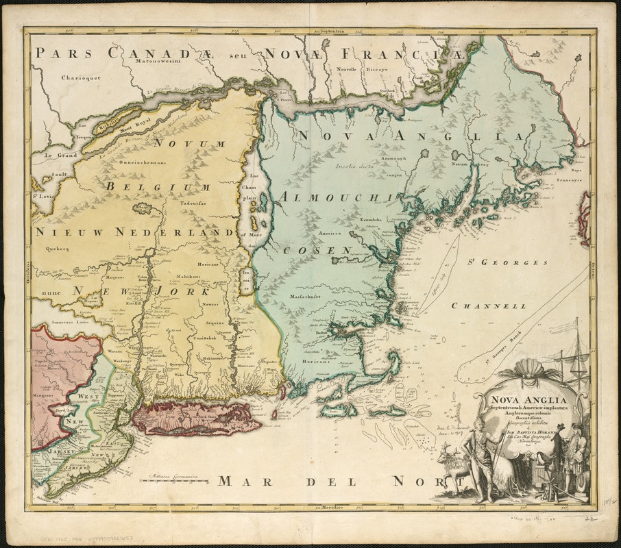
Nova Anglia Septentrionali Americae implantata Anglorumque coloniis florentissima geographicè exhibita
This map is also available in American Revolutionary Geographies Online (ARGO), a collections portal especially built for material relating to the American Revolutionary War Era. Visit ARGO to learn more about this item and explore the historical geography of North America in the late eighteenth century.
Item Information
- Title:
- Nova Anglia Septentrionali Americae implantata Anglorumque coloniis florentissima geographicè exhibita
- Creator:
- Homann, Johann Baptist, 1663-1724
- Name on Item:
-
à Ioh. Baptista Homann.
- Date:
-
[1720?]
- Format:
-
Maps/Atlases
- Location:
-
Boston Public Library
Norman B. Leventhal Map & Education Center - Collection (local):
-
Norman B. Leventhal Map & Education Center Collection
- Subjects:
-
Northeastern States--Maps--Early works to 1800
- Places:
-
Northeastern United States (area)
- Extent:
- 1 map : col. ; 47 x 56 cm.
- Terms of Use:
-
No known copyright restrictions.
No known restrictions on use.
- Publisher:
-
Norimbergae :
[Ioh. Baptista Homann]
- Scale:
-
Scale [ca. 1:382,450].
- Language:
-
Latin
- Notes:
-
Relief shown pictorially.
Map features New Jersey, New York and New England.
Listed in Phillips as in "Atlas geographicus major". Norimbergae, Homannianis Heredibus, 1759.
- Identifier:
-
06_01_006233
- Call #:
-
G3710 1759 .H66
- Barcode:
-
39999059021657


