Toggle navigation
LMEC Home
Exhibitions
Georeferencing
Tools for Teachers
Collections
My Favorites
Sign Up / Log In
Search
Search the map portal
Map Collection
Map Collection
Map Sets
Search
Search
Search for
Search In
All Fields
Creator
Title
Subject
Place
Search All Digital Collections
Advanced Search
150 Results
My Search
Start Over
1873
Remove constraint 1873
Filter your Search
Place
North and Central America
88
United States
60
Europe
18
Boston
16
Suffolk (county)
16
Asia
11
Canada
9
Mexico
7
more
Place
»
Topic
Pictorial maps
12
Boston (Mass.)--Maps
8
California, Gulf of (Mexico)--Maps
4
United States--Maps
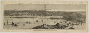
4
Cambridge (Mass.)--Maps
3
Canada--Maps
3
Great Fire, Boston, Mass., 1872--Maps
3
Landowners--Massachusetts--Boston--Maps
3
more
Topic
»
Date
Date range begin
–
Date range end
Current results range from
1625
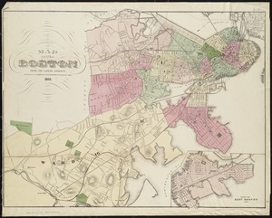
to
1985
View distribution
Creator
United States. Hydrographic Office
48
Harvey, William, 1796-1873
12
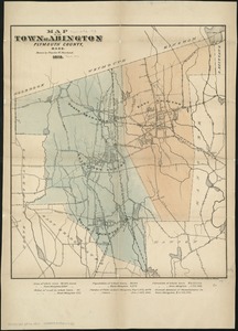
Hodder and Stoughton
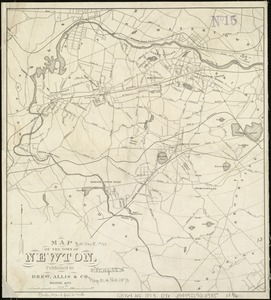
12
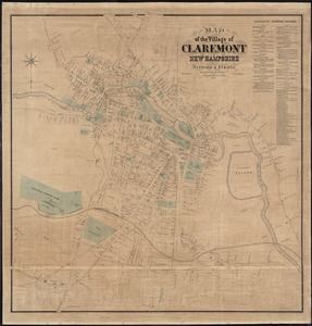
Lancaster, Elizabeth Lilian, 1852-1939
12
Vincent Brooks, Day & Son
12
Maury, Matthew Fontaine, 1806-1873
5
Beers, F. W. (Frederick W.)
4
Comstock, C. B. (Cyrus Ballou), 1831-1910
4
more
Creator
»
Format
Maps/Atlases
150
Manuscripts
1
Georeferenced
Yes
16
No
134
Collection
Norman B. Leventhal Map Center Collection
140
Maritime Charts and Atlases
53
Urban Maps
38
Boston and New England Maps
35
Massachusetts Real Estate Atlases
3
Town plans, 1830
3
American Revolutionary War-Era Maps
2
Boston Redevelopment Authority Collection
1
more
Collection
»
Available to use
No known restrictions
144
Creative Commons license
3
Search Constraints
Sort by date (desc)
relevance
title
date (asc)
date (desc)
Number of results to display per page
100 per page
10
per page
20
per page
50
per page
100
per page
View results as:
grid view
map view
Search Results
1.
Whale chart
2.
Boston thorofare plan existing routes and proposals
3.
Map of Connecticut, circa 1625, Indian trails, villages, sachemdoms
4.
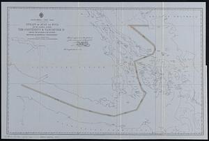
North America--west coast, Strait of Juan de Fuca and the channels between the continent & Vancouver Id. showing the boundary...
5.
Chart of Detroit River
6.
Chart of Lake Saint Clair
7.
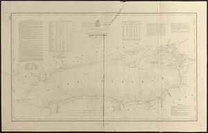
Lake Ontario
8.
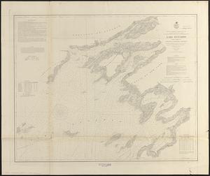
Lake Ontario
9.
U.S. North Pacific Surveying Expedition ... Amakirima Group with part of Loo-Choo by the Vincennes, John Hancock and Fenimore...
10.
West Indies, north coast of Santo Domingo, Port Plata
11.
Cape Verde Islands, Porto Grande in the island of St. Vincent
12.
Central-America, southern shore of the Caribbean Sea, harbor of San Juan del Norte or Greytown
13.
Dominion of Canada, Gulf of Saint Lawrence, Port Hood (Cape Breton Island) : from British surveys in 1847 & 1873
14.
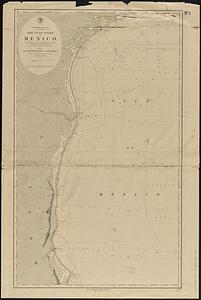
North America, east coast, Gulf of Mexico, the Gulf coast of Mexico, sheet 1 : from the Rio Grande to Cape Roxo
15.
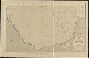
North America, east coast, Gulf of Mexico, the Gulf coast of Mexico, sheet 2 : from Tampico to Campeche Bank
16.
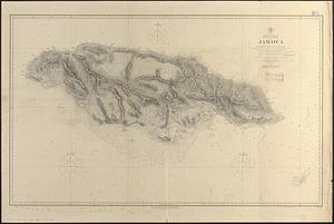
North America, east coast, West Indies, Jamaica : from British surveys from 1873 to 1881
17.
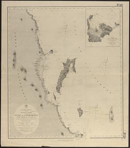
North America, west coast, lower California, western shore of the Gulf of California, from Pulpito Point (San Basilio Bay) to...
18.
North America, west coast, lower California, western shore of the Gulf of California, from Sn. Marcial Pt. to Sn. Basilio Bay
19.
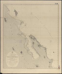
North America, west coast, west coast of Mexico and the Gulf of California : from a survey by Comdr. Geo. Dewey U.S.N., and the...
20.
North America, west coast, west coast of Mexico from Mazatlan to Tenacatita Bay : from a survey made by Comdr. Geo. Dewey...
21.
North America, west coast, anchorages in the Gulf of California : from a survey by Commander Geo. Dewey, U.S.N. and the...
22.
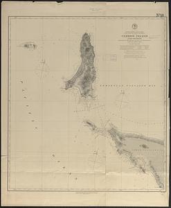
North America, west coast, west coast of lower California, Cerros Island and vicinity
23.
West Indies--Bahama Islands, Inagua Island anchorages : from British surveys, corrected to 1873
24.
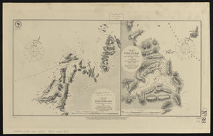
South America, west coast, Port Barbara : from a British survey corrected to 1877 ; South America, west coast, Port Otway in...
25.
Insurance maps of Boston volume one
26.
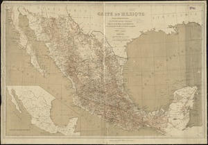
Carte du Mexique
27.
1879. Progress map of the U.S. Geographical Surveys west of the 100th Meridian : prepared under the direction of 1st Lieut....
28.
The City of Boston : 1879
29.
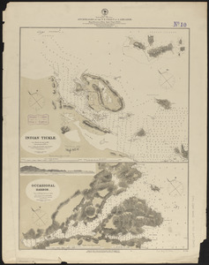
Sulu Sea, Cagayan Sulu and adjacent islands
30.
City of Cambridge, Mass : 1877
31.
North America, east coast, anchorages on the n.e. coast of Labrador : republication of Brit. Admty. chart no. 225
32.
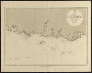
North America, south coast of Newfoundland : Devil Bay to Knife Bay : from a British survey in 1872 & 1873 ; republication of...
33.
Plan of burnt district by fire of Nov. 9th and 10th, 1872 : showing street improvements as adopted by Board of Street...
34.
West Indies, south coast of Jamaica, approaches to Port Royal and Kingston Hr. : from British surveys in 1873-74 ;...
35.
Canary Islands, Tenerife, Santa Cruz
36.
Carte du Bassin du Mackenzie, dressée de 1862 à 1873
37.
North America, west coast, anchorages in the Gulf of California : from a reconnaissance by the officers of the U.S.S....
38.
North America, west coast, ports on the west coast of Lower California : from British surveys in 1847, with additions by Comdr....
39.
West Indies, Jamaica--south coast, Port Morant : surveyed by Staff Commander G. Stanley, R.N. 1873 ; republication of British...
40.
Africa--north coast, Strait of Gibraltar, Tangier Bay : from a French survey in 1855 ; republication of the Brit. Admty. chart...
41.
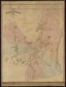
Map of the city of Worcester
42.
Map showing in five degrees of density the distribution of woodland within the territory of the United States, 1873
43.
Progress chart of the Survey of the Northern & North Western Lakes, July 1st, 1873 : primary triangulation, telegraphic...
44.
Skeleton map of the territory of the United States west of the Mississippi River : exhibiting the relations existing between...
45.
Temperature chart of the United States : showing the distribution by isothermal curves of the mean annual temperature of the...
46.
Annexation map
47.
Atlas of the city of Cambridge, Middlesex Co., Massachusetts
48.
Atlas of the city of Cambridge, Middlesex Co., Massachusetts
49.
Atlas of the county of Suffolk, Massachusetts : vol. 2nd late city of Roxbury, now wards 13-14 and 15, city of Boston
50.
Atlas of the county of Suffolk, Massachusetts, vol. 2 : late city of Roxbury, now wards 13-14 and 15, city of Boston
51.
Azores, Corvo and Flores
52.
Bancroft's official guide map of city and county of San Francisco : compiled from official maps in Surveyor's Office
53.
Bancroft's official guide map of city and county of San Francisco : compiled from official maps in Surveyor's Office
54.
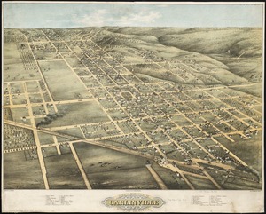
Bird's eye view of Carlinville, Macoupin County Ill : 1873
55.
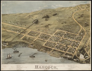
Bird's eye view of Hancock, L.S. Mich, 1873 : looking north west
56.
Bird's eye view of Waterloo : Seneca County, N.Y., 1873
57.
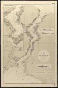
The Bosphorus : from French and British surveys in 1853, corrected to 1872
58.
Boston, Feb. 20 1873
59.
Chart of Boston Harbor : from the best authorities, 1873
60.
The city of Boston
61.
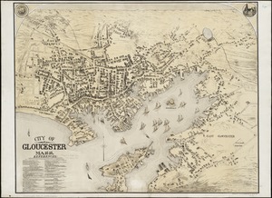
City of Gloucester, Mass
62.
City of Toronto : compiled from surveys made to the present date
63.
Colton's new railroad map of the United States & Canada
64.
Compiled plan, showing Millers Creek and a portion of Charles River
65.
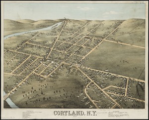
Cortland, N.Y : 1873
66.
County atlas of Hampshire, Massachusetts
67.
County atlas of Hampshire, Massachusetts : from actual surveys
68.
Dawson's map of the Dominion of Canada
69.
England--south coast, Portland Harbor : republished from British Admy. chart no. 2268
70.
Environs of Dartmoor : compiled for the autumn manœuvers (south division), showing the various encampments, and divided into...
71.
Fitton Bay (Peel Id.) from the survey of Captain F.W. Beechey, R.N. 1827 ; Coffin Group by officers of the U.S. Ship Plymouth,...
72.
Government map of part of the Huron and Ottawa Territory, Ontario
73.
Indian Ocean, Gulf of Aden--North coast, Aden and adjacent bays : republished from the Brit. Admty chart no. 7, corrected to 1873
74.
Japan-Yezo Id., e. coast, Akishi Bay : republished from the Brt. Admty. chart no. 992, corrected to 1873
75.
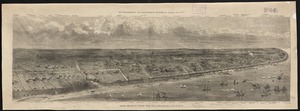
Long Branch, from the sea
76.
Map of Boston from the latest surveys
77.
Map of California and Nevada
78.
Map of Chippewa County, state of Wisconsin
79.
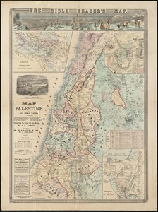
Map of Palestine and all Bible lands, containing the ancient and modern names of all known places, a table of seasons, weather,...
80.
Map of Surf-Side, the property of the Nantucket Surf-Side Company
81.
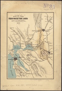
Map of the fresh water tide lands of California
82.
Map of the principal part of Boston, and adjacent cities, for 1873
83.
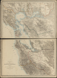
Map of the region adjacent to the bay of San Francisco
84.
Map of the town of Abington Plymouth County, Mass
85.
Map of the town of Newton
86.
Map of the village of Claremont, New Hampshire
87.
Mediterranean, New Mole Harbor, Gibraltar
88.
Newport, Rhode Island
89.
North Pacific Ocean, atolls in the Marshall Group : from an examination by the U.S.S. "Narragansett", Comdr. R.W. Meade, in 1872
90.
North Pacific Ocean-- Caroline Is., Ascension I. (Pouinipet or Ponape I.), Kiti Harbor
91.
North Pacific Ocean, Caroline Islands, Seniavine Islands : from French, Russian and U.S. surveys, corrected to 1873
92.
Plan of burnt district, by fire of Nov. 9th and 10th 1872 : showing street improvements as adopted by Board of Street...
93.
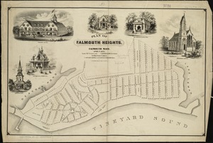
Plan of Falmouth Heights, Falmouth Mass., April 1st 1873
94.
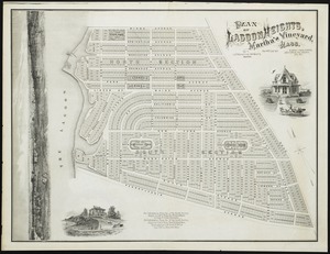
Plan of Lagoon Heights, Martha's Vineyard, Mass
95.
Plan of land on West Chester Park and Huntington Ave. belonging to the Boston Water Power Co
96.
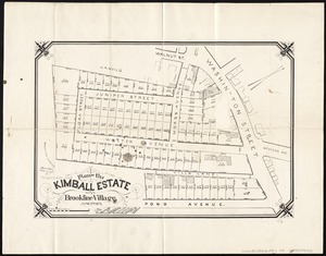
Plan of the Kimball Estate in Brookline Village : June 2nd 1873
97.
Plan of the town of Brighton
98.
Plan of the town of West Roxbury : compiled from various plans and surveys, by order of the selectmen
99.
Portion of the copper district, Michigan, Lake Superior
100.
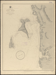
Ports in the Philippine Islands
‹ Prev
Next ›
1
2