Whale chart
Item Information
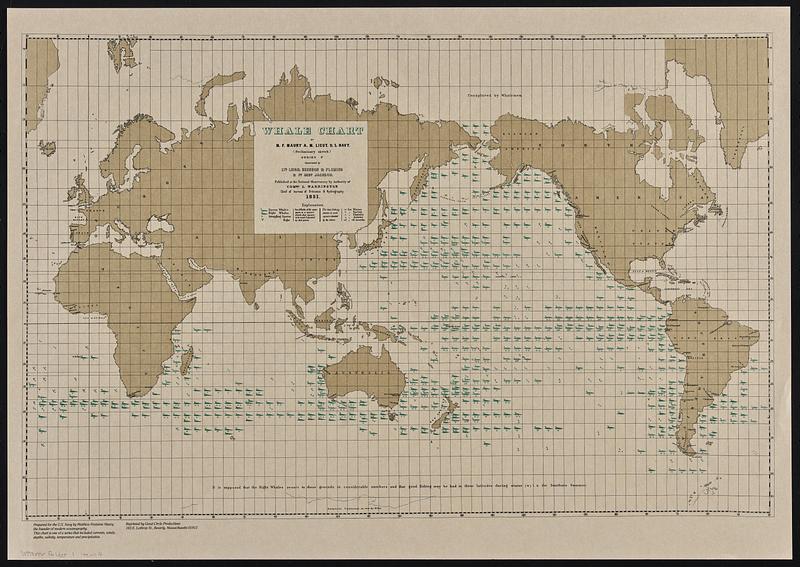
- Title:
- Whale chart
- Cartographer:
- Maury, Matthew Fontaine, 1806-1873
- Publisher:
- Great Circle Productions (Firm)
- Name on Item:
-
by M.F. Maury ... (preliminary sketch) : series F ; constructed by Lts. Leigh. Herndon & Fleming & Pd. Midn. Jackson.
- Date:
-
[1985]
- Format:
-
Maps/Atlases
- Genre:
-
World maps
- Location:
-
Boston Public Library
Norman B. Leventhal Map & Education Center - Collection (local):
-
David Judkins Weaver Papers
- Subjects:
-
Whales--Maps
Whaling--Maps
- Places:
-
World
- Extent:
- 1 map : color ; 36 x 56 cm
- Terms of Use:
-
No known copyright restrictions.
No known restrictions on use.
- Publisher:
-
Beverly, Massachusetts :
Great Circle Productions
- Scale:
-
Scale approximately 1:74,000,000 at the equator
- Language:
-
English
- Notes:
-
Shows seasonal variations and frequency of sperm and right whales in the Pacific, and other waters in the southern hemisphere.
"Prepared for the U.S. Navy by Matthew Fontaine Maury, the founder of modern oceanography. This chart is one of a series that included currents, winds, depths, salinity, temperature and precipitation."
- Notes (date):
-
This date is inferred.
- Identifier:
-
06_01_018551
- Call #:
-
Weaver folder 1 no. 4


