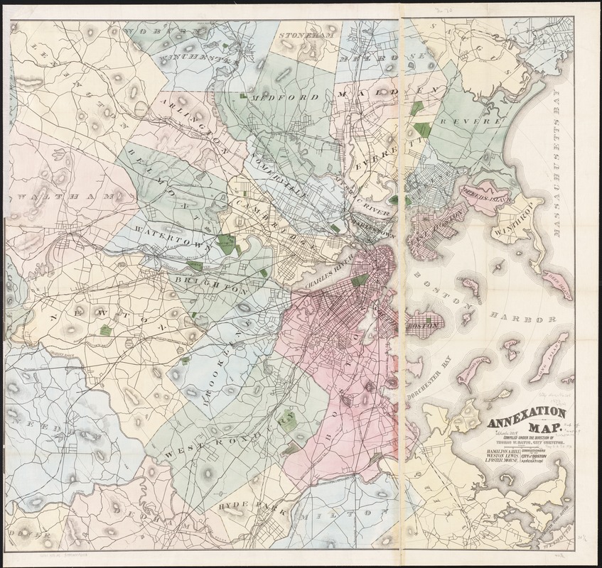
Annexation map
Item Information
- Title:
- Annexation map
- Creator:
- Davis, Thomas W., surveyor
- Name on Item:
-
compiled under the direction of Thomas W. Davis ; Hamilton A. Hill, Weston Lewis, L. Foster Morse [for the] Commissioners of the City of Boston on Annexation.
- Date:
-
[1873]
- Format:
-
Maps/Atlases
- Location:
-
Boston Public Library
Norman B. Leventhal Map & Education Center - Collection (local):
-
Norman B. Leventhal Map & Education Center Collection
- Subjects:
-
Annexation (Municipal government)--Massachusetts--Boston--Maps
Boston (Mass.)--Maps
Massachusetts--Maps
- Places:
-
MassachusettsSuffolk (county)Boston
- Extent:
- 1 map : col. ; 98 x 105 in.
- Terms of Use:
-
No known copyright restrictions.
No known restrictions on use.
- Publisher:
-
Boston, Mass :
City Surveyor
- Scale:
-
Scale 1:25,548.
- Language:
-
English
- Notes:
-
Relief shown by hachures.
- Notes (date):
-
This date is inferred.
- Identifier:
-
06_01_002661
- Call #:
-
G3760 1873 .A5
- Barcode:
-
39999058996800

![[Boston and Northwestern Junction Railroad]](https://bpldcassets.blob.core.windows.net/derivatives/images/commonwealth:x059cc74n/image_thumbnail_300.jpg)


