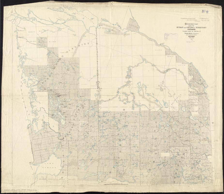
Government map of part of the Huron and Ottawa Territory, Ontario
Item Information
- Title:
- Government map of part of the Huron and Ottawa Territory, Ontario
- Creator:
- Devine, Thomas, draughtsman
- Name on Item:
-
compiled under the direction of Thomas Devine, F.R.G.S. &c., deputy surveyor general.
- Date:
-
1873
- Format:
-
Maps/Atlases
- Location:
-
Boston Public Library
Norman B. Leventhal Map & Education Center - Collection (local):
-
Norman B. Leventhal Map & Education Center Collection
- Subjects:
-
Ontario--Maps
Canada--Maps
- Places:
-
CanadaOntario (province)
- Extent:
- 1 map : col. ; 77 x 86 cm.
- Terms of Use:
-
No known copyright restrictions.
No known restrictions on use.
- Publisher:
-
Ontario :
Department of Crown Lands
- Scale:
-
Scale 1:316,800
- Language:
-
English
- Notes:
-
Oriented with north to the upper right.
Relief shown by hachures.
- Identifier:
-
06_01_011719
- Call #:
-
G3460 1873 .D48
- Barcode:
-
39999065688176