Map of the principal part of Boston, and adjacent cities, for 1873
Item Information
- Title:
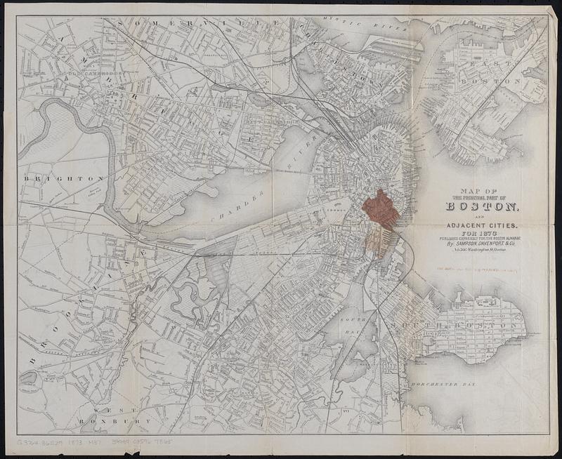
- Map of the principal part of Boston, and adjacent cities, for 1873
- Publisher:
- Sampson, Davenport & Co.
- Name on Item:
-
published expressly for the Boston Almanac by Sampson, Davenport & Co.
- Date:
-
1873
- Format:
-
Maps/Atlases
- Location:
-
Boston Public Library
Norman B. Leventhal Map & Education Center - Collection (local):
-
Norman B. Leventhal Map & Education Center Collection
- Subjects:
-
Boston (Mass.)--Maps
Great Fire, Boston, Mass., 1872--Maps
- Places:
-
MassachusettsSuffolk (county)Boston
- Extent:
- 1 map : color ; 39 x 49 cm
- Terms of Use:
-
No known copyright restrictions.
No known restrictions on use.
- Publisher:
-
Boston :
Sampson, Davenport & Co.
- Scale:
-
Scale approximately 1:20,000
- Language:
-
English
- Notes:
-
"The burnt district is represented in color."
- Identifier:
-
06_01_018477
- Call #:
-
G3764.B6E29 1873 .M37
- Barcode:
-
39999085967865


