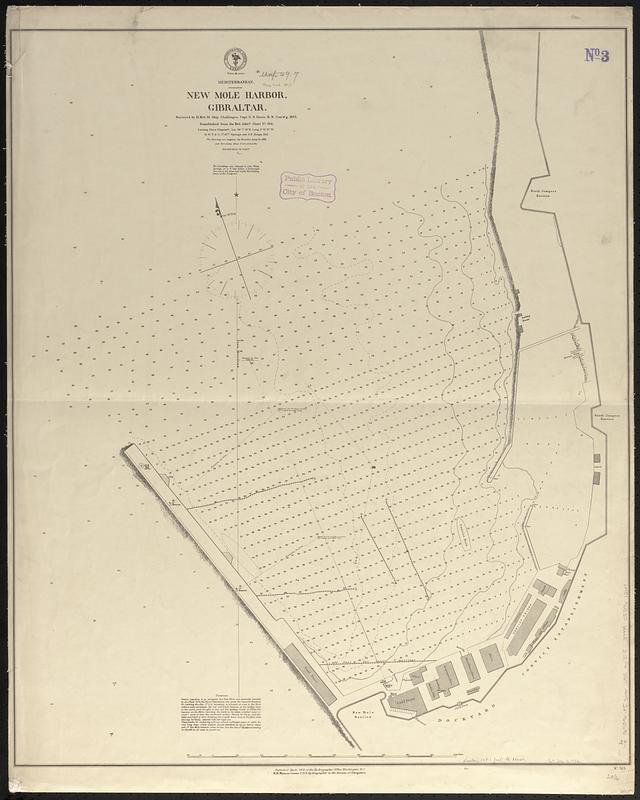
Mediterranean, New Mole Harbor, Gibraltar
Item Information
- Title:
- Mediterranean, New Mole Harbor, Gibraltar
- Issuing body:
- United States. Hydrographic Office
- Surveyor:
- Nares, George S. (George Strong), 1831-1915
- Name on Item:
-
surveyed by H. Brit. M. Ship Challenger, Capt. G.S. Nares R.N. com'd'g, 1873 ; republished from the Brit. Admty. chart no. 524
- Date:
-
1873
- Format:
-
Maps/Atlases
- Genre:
-
Nautical charts
- Location:
-
Boston Public Library
Norman B. Leventhal Map & Education Center - Collection (local):
-
Norman B. Leventhal Map & Education Center Collection
- Subjects:
-
Gibraltar--Maps
Harbors--Gibraltar--Maps
Nautical charts--Gibraltar
- Places:
-
Gibraltar (territory)
- Extent:
- 1 map ; 74 x 62 cm
- Terms of Use:
-
No known copyright restrictions.
No known restrictions on use.
- Publisher:
-
Washington, D.C. :
Hydrographic Office
- Scale:
-
Scale approximately 1:1,240
- Language:
-
English
- Notes:
-
Depths shown by soundings and isolines.
Also shows buildings and beacons.
- Identifier:
-
06_01_017667
- Call #:
-
G9096.P5 svar .U55 no. 515
- Barcode:
-
39999085961264


