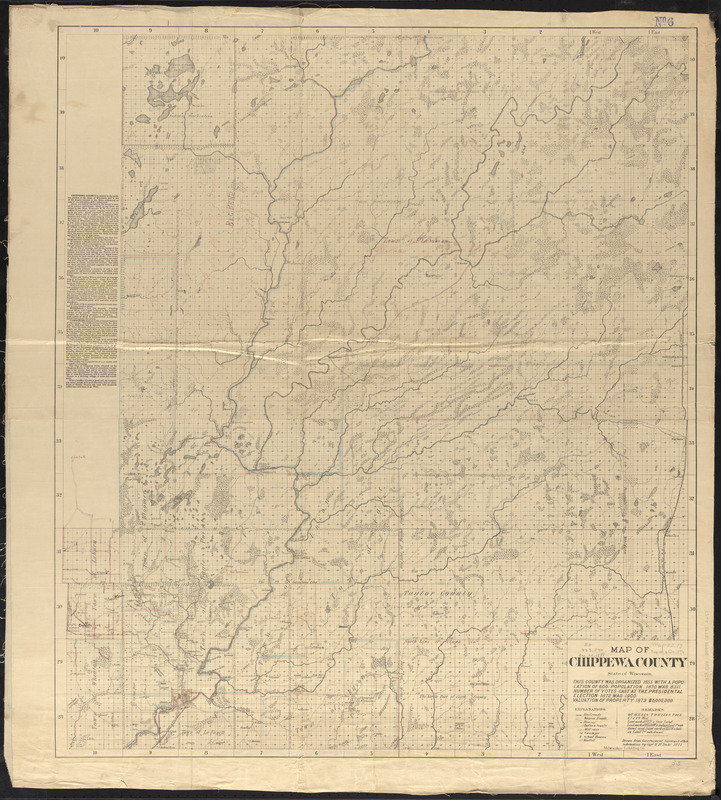
Map of Chippewa County, state of Wisconsin
Item Information
- Title:
- Map of Chippewa County, state of Wisconsin
- Cartographer:
- Dahl, O. R. (Ole Rasmussen), 1817-1882
- Publisher:
- Milwaukee Lith. & Engr. Co.
- Name on Item:
-
drawn from governement surveys & other information by Capt. O.R. Dahl
- Date:
-
1873
- Format:
-
Maps/Atlases
- Location:
-
Boston Public Library
Norman B. Leventhal Map & Education Center - Collection (local):
-
Norman B. Leventhal Map & Education Center Collection
- Subjects:
-
Landowners--Wisconsin--Chippewa County--Maps
Landowners--Wisconsin--Clark County--Maps
Landowners--Wisconsin--Price County--Maps
Landowners--Wisconsin--Rusk County--Maps
Landowners--Wisconsin--Sawyer County--Maps
Landowners--Wisconsin--Taylor County--Maps
Chippewa County (Wis.)--Maps
Clark County (Wis.)--Maps
Price County (Wis.)--Maps
Rusk County (Wis.)--Maps
Sawyer County (Wis.)--Maps
Taylor County (Wis.)--Maps
- Places:
-
WisconsinChippewa (county)
WisconsinClark (county)
WisconsinPrice (county)
WisconsinRusk (county)
WisconsinSawyer (county)
WisconsinTaylor (county)
- Extent:
- 1 map ; 97 x 84 cm, on sheet 106 x 95 cm
- Terms of Use:
-
No known copyright restrictions.
No known restrictions on use.
- Publisher:
-
[Milwaukee] :
Milwaukee Lith & Eng Co.
- Scale:
-
Scale approximately 1:126,720
- Language:
-
English
- Notes:
-
Covers Chippewa, Clark, Price, Rusk, Sawyer and Taylor Counties.
Shows township and range grid, towns, sections, cities, settlements, railroads, wagon roads, houses, Indian trails, mill sites, swamps, school houses, and windfalls.
Includes text about Chippewa County in left margin.
Valuation of property is for 1873.
- Identifier:
-
06_01_016766
- Call #:
-
G4123.C4 1873 .D34
- Barcode:
-
39999085952651


