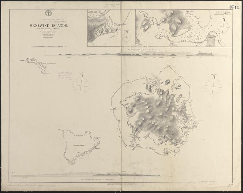
North Pacific Ocean, Caroline Islands, Seniavine Islands : from French, Russian and U.S. surveys, corrected to 1873
Item Information
- Title:
- North Pacific Ocean, Caroline Islands, Seniavine Islands : from French, Russian and U.S. surveys, corrected to 1873
- Issuing body:
- United States. Hydrographic Office
- Date:
-
1873
- Format:
-
Maps/Atlases
- Genre:
-
Nautical charts
- Location:
-
Boston Public Library
Norman B. Leventhal Map & Education Center - Collection (local):
-
Norman B. Leventhal Map & Education Center Collection
- Subjects:
-
Senyavin Islands (Micronesia)--Maps
Nautical charts--Micronesia (Federated States)--Senyavin Islands
- Places:
-
Federated States of MicronesiaPohnpeianSenyavin Islands (area)
- Extent:
- 1 map ; 64 x 83 cm
- Terms of Use:
-
No known copyright restrictions.
No known restrictions on use.
- Publisher:
-
Washington, D.C. :
Hydrographic Office
- Scale:
-
Scale approximately 1:102,000
- Language:
-
English
- Notes:
-
Relief shown by hachures and spot heights. Depths shown by soundings and pictorially.
Includes 2 coastal views.
Insets: Port Lod -- Port Métalanim.
- Identifier:
-
06_01_017526
- Call #:
-
G9096.P5 svar .U55 no. 425
- Barcode:
-
39999085960381


