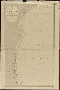
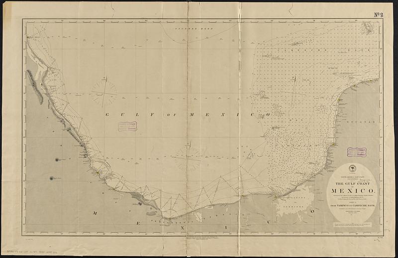
North America, east coast, Gulf of Mexico, the Gulf coast of Mexico, sheet 2 : from Tampico to Campeche Bank
Item Information
- Title:
- North America, east coast, Gulf of Mexico, the Gulf coast of Mexico, sheet 2 : from Tampico to Campeche Bank
- Issuing body:
- United States. Hydrographic Office
- Surveyor:
- Baker, Francis M.
- Surveyor:
- Green, F. M. (Francis Mathews), 1835-1902
- Name on Item:
-
surveyed by the officers of the U.S. Ships Wyoming, Comdr. F.H. Baker, and Fortune, Lt. Comdr. F.M. Green, 1873-74, the Bay of Campeche from the Brit. Admty. Survey in 1844
- Date:
-
[1888]
- Format:
-
Maps/Atlases
- Genre:
-
Nautical charts
- Location:
-
Boston Public Library
Norman B. Leventhal Map & Education Center - Collection (local):
-
Norman B. Leventhal Map & Education Center Collection
- Subjects:
-
Mexico, Gulf of--Maps
Gulf Coast (Mexico)--Maps
Nautical charts--Mexico, Gulf of
- Places:
-
Mexico, Gulf of
- Extent:
- 1 map ; 63 x 106 cm
- Terms of Use:
-
No known copyright restrictions.
No known restrictions on use.
- Publisher:
-
Washington, D.C. :
Hydrographic Office
- Edition:
- Edition of September 1888
- Scale:
-
Scale approximately 1:855,000
- Language:
-
English
- Notes:
-
Relief shown by hachures and spot heights. Depths shown by hachures and spot heights.
- Notes (date):
-
This date is inferred.
- Identifier:
-
06_01_017068
- Call #:
-
G9096.P5 svar .U55 no. 705
- Barcode:
-
39999085953576