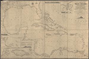
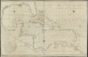
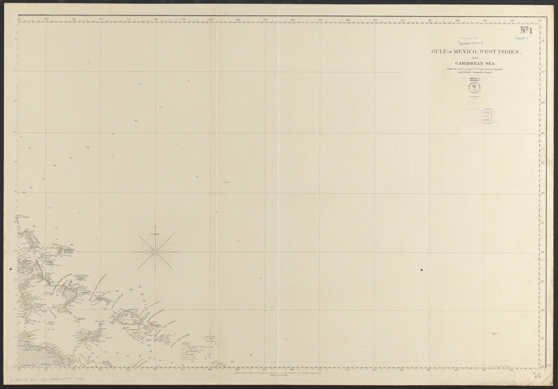
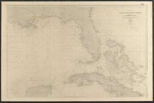
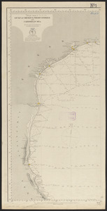
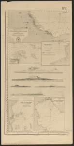
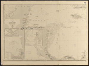
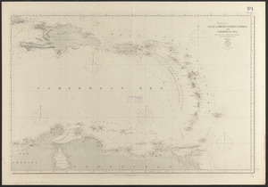
Gulf of Mexico, West Indies and Caribbean Sea : from the most recent U.S. Coast Survey, Spanish and British Admiralty charts

Item Information
- Title:
- Gulf of Mexico, West Indies and Caribbean Sea : from the most recent U.S. Coast Survey, Spanish and British Admiralty charts
- Issuing body:
- United States. Hydrographic Office
- Date:
-
1889
- Format:
-
Maps/Atlases
- Location:
-
Boston Public Library
Norman B. Leventhal Map & Education Center - Collection (local):
-
Norman B. Leventhal Map & Education Center Collection
- Subjects:
-
Nautical charts--Caribbean Sea
Nautical charts--Mexico, Gulf of
Nautical charts--West Indies
Caribbean Area--Maps
Caribbean Sea--Maps
Mexico, Gulf of--Maps
West Indies--Maps
- Places:
-
Caribbean Sea
West Indies
- Extent:
- 1 map on 6 sheets : hand colored ; 125 x 213 cm, on sheets 71 x 107 cm.
- Terms of Use:
-
No known copyright restrictions.
No known restrictions on use.
- Publisher:
-
Washington, D.C. :
Hydrographic Office
- Edition:
- Edition of February 1889
- Scale:
-
Scale approximately 1:2,200,000
- Language:
-
English
- Notes:
-
Insets: Anton Lizarto anchorage -- Aguadilla anchorage -- Port of Vera Cruz -- A survey of the harbour of Jaquemal in the island of St. Domingo -- Gulf of Darien -- Bay and harbour of Port au Prince, in the island of Haiti -- Limon or Navy Bay (Puerto de Naos).
Includes 5 views.
- Identifier:
-
06_01_015527A
06_01_015527B
06_01_015527C
06_01_015527D
06_01_015527E
06_01_015527F
- Call #:
-
G4391.P5 1889 .U55
- Barcode:
-
39999085937454