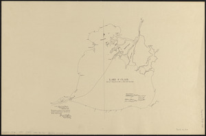
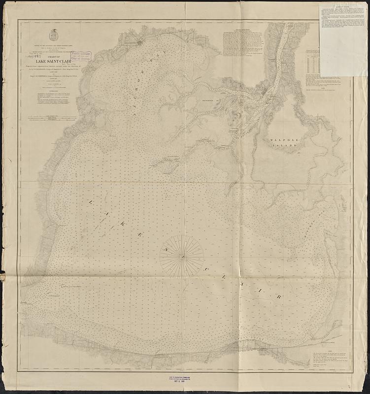
Chart of Lake Saint Clair
Item Information
- Title:
- Chart of Lake Saint Clair
- Issuing body:
- U.S. Lake Survey
- Surveyor:
- Raynolds, W. F. (William Franklin), 1820-1894
- Surveyor:
- Comstock, C. B. (Cyrus Ballou), 1831-1910
- Surveyor:
- Farquhar, F. U. (Francis Ulric)
- Surveyor:
- Gregory, James F. (James Fingal), 1843-1897
- Surveyor:
- Livermore, W. R. (William Roscoe), 1843-1919
- Surveyor:
- Wisner, G. Y.
- Surveyor:
- Flint, A. R.
- Surveyor:
- Green, B. D.
- Surveyor:
- Chaffee, O. N.
- Surveyor:
- Mayer, J. R.
- Surveyor:
- Molitor, Albert
- Surveyor:
- Lamson, A. C.
- Surveyor:
- Towar, F. M.
- Draftsman:
- Molitor, E. (Edward)
- Contributor:
- United States. War Department. Corps of Engineers
- Name on Item:
-
projected from trigonometrical surveys executed under the direction of Lt. Col. W.F. Raynolds, Corps of Engineers & Brvt. Brig. Genl. U.S.A. in 1867 & 1868 and Major C.B. Comstock, Corps of Engineers & Brt. Brig. Genl. U.S.A. in 1870 & 1871 ; drawn in 1873 and 1874 ; triangulation by Capt. F.U. Farquhar Corps of Engrs. and First Lieuts. J.F. Gregory and W.R. Livermore Corps of Engrs. and Assistants G.Y. Wisner and A.R. Flint ; off shore hydrography by Lieuts. J.F. Gregory and W.R. Livermore ; shore line topography and hydrography by Lieuts. J.F. Gregory, W.R. Livermore and B.D. Green Corps of Engrs. and Assistants O.N. Chaffee, J.R. Mayer, Albert Molitor, A.C. Lamson & F.M. Towar ; compilation and drawing for engraving by Assist. Edward Molitor
- Date:
-
[1891]
- Format:
-
Maps/Atlases
- Genre:
-
Nautical charts
- Location:
-
Boston Public Library
Norman B. Leventhal Map & Education Center - Collection (local):
-
Norman B. Leventhal Map & Education Center Collection
- Subjects:
-
Saint Clair, Lake (Mich. and Ont.)--Maps
Nautical charts--Saint Clair, Lake (Mich. and Ont.)
- Places:
-
Saint Clair, Lake
- Extent:
- 1 map ; 93 x 88 cm
- Terms of Use:
-
No known copyright restrictions.
No known restrictions on use.
- Publisher:
-
[Washington, D.C.] :
[U.S. Lake Survey]
- Scale:
-
Scale 1:50,000
- Language:
-
English
- Notes:
-
Depths shown by soundings and isolines. Relief shown by hachures.
Also shows lighthouses, composition of lake bottom, and shoreline land use and buildings.
Includes: Authorities -- Sailing directions -- Water table -- Note.
"Made in obedience to acts of Congress and orders from Headquarters of the Corps of Engineers, War Department."
"Aids to navigation corrected to October 12, 1889."
Stamped in lower margin: Aids to navigation corrected from information received to Oct 1 1891.
Note issued 1894 tipped-on in upper right.
- Notes (date):
-
This date is inferred.
- Identifier:
-
06_01_017444
- Call #:
-
G3312.S43P53 1891 .U83
- Barcode:
-
39999085959201