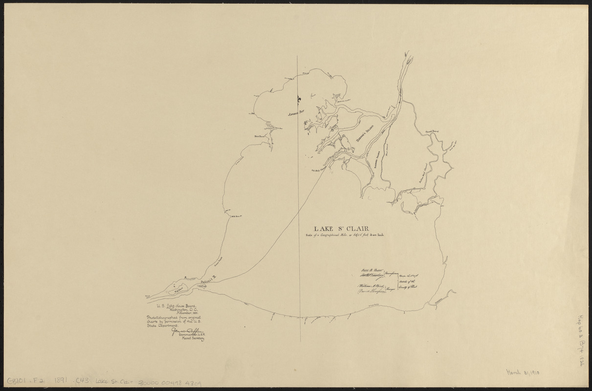
Lake St. Clair
Item Information
- Title:
- Lake St. Clair
- Title (uniform):
-
Charts for the international boundary between the United States and the Dominion of Canada
- Contributor:
- Barclay, Anthony, 1792-1877
- Surveyor:
- Bird, William A., 1797-1878
- Contributor:
- Porter, Peter B. (Peter Buell), 1773-1844
- Surveyor:
- Thompson, David, 1770-1857
- Publisher:
- United States. Light-House Board
- Name on Item:
-
Peter B. Porter, Anthony Barclay, commissioners ; William A. Bird, David Thompson, surveyors ; under the 6th & 7th articles of the Treaty of Ghent
- Date:
-
1891
- Format:
-
Maps/Atlases
- Location:
-
Boston Public Library
Norman B. Leventhal Map & Education Center - Collection (local):
-
Norman B. Leventhal Map & Education Center Collection
- Subjects:
-
Canada--Boundaries--United States--Maps
Saint Clair, Lake (Mich. and Ont.)--Maps
United States--Boundaries--Canada--Maps
United States--History--War of 1812--Territorial questions--Maps
- Places:
-
Saint Clair, Lake
- Extent:
- 1 map ; 40 x 61 cm
- Terms of Use:
-
No known copyright restrictions.
No known restrictions on use.
- Publisher:
-
Washington D.C. :
U.S. Light-House Board
- Scale:
-
Scale approximately 1:175,000
- Language:
-
English
- Notes:
-
Photolithographed from original charts by permission of the U.S. State Department.
Part of a set of maps [Charts for the international boundary between the United States and the Dominion of Canada].
- Identifier:
-
06_01_008489
- Call #:
-
G3701.F2 1891 .C43 Lake St. Clair
- Barcode:
-
30000004984309