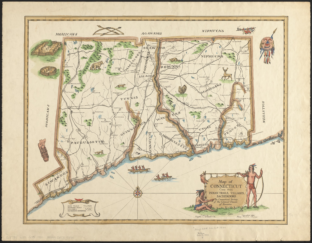
Map of Connecticut, circa 1625, Indian trails, villages, sachemdoms
Item Information
- Title:
- Map of Connecticut, circa 1625, Indian trails, villages, sachemdoms
- Artist:
- Griswold, Hayden L.
- Compiler:
- Spiess, Mathias, 1873-
- Copyright holder:
- Cheney, Mary Pierson
- Publisher:
- National Society of the Colonial Dames of America in the State of Connecticut
- Name on Item:
-
the Connecticut Society of The Colonial Dames of America ; drawn by Hayden L. Griswold C.E. ; compiled by Mathis Spiess
- Date:
-
1930
- Format:
-
Maps/Atlases
- Location:
-
Boston Public Library
Norman B. Leventhal Map & Education Center - Collection (local):
-
Norman B. Leventhal Map & Education Center Collection
- Subjects:
-
Indians of North America--Connecticut--Maps
Connecticut--History--Maps
- Places:
-
Connecticut
- Extent:
- 1 map : color ; 42 x 54 cm
- Terms of Use:
-
No known copyright restrictions.
No known restrictions on use.
- Publisher:
-
[South Manchester, Connecticut] :
Connecticut Society of the Colonial Dames of America
- Scale:
-
Scale approximately 1:350,000
- Language:
-
English
- Notes:
-
Relief shown pictorially.
Includes illustrations.
Accompanied by booklet titled Connecticut circa 1625, its Indian trails, villages and Sachemdoms.
- Identifier:
-
06_01_014762
- Call #:
-
G3780 1625 .G75 1930
- Barcode:
-
39999065705194


