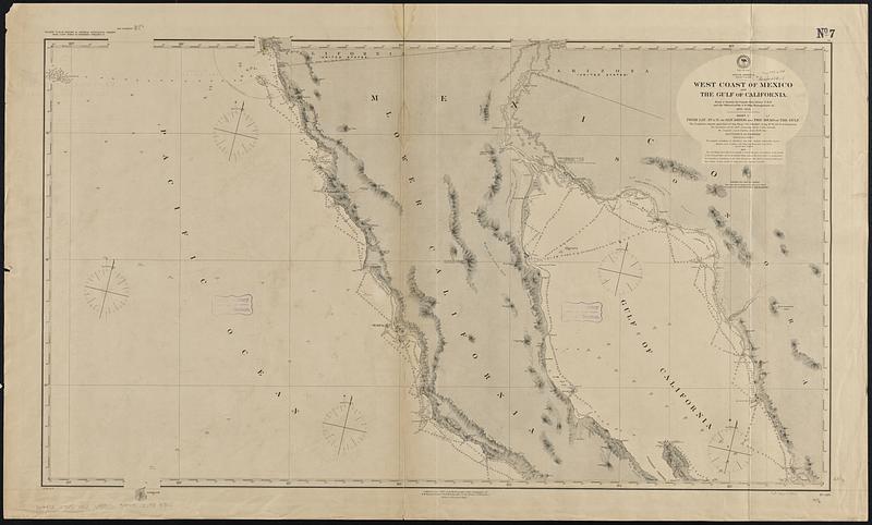
North America, west coast, west coast of Mexico and the Gulf of California : from a survey by Comdr. Geo. Dewey U.S.N., and the officers of the U.S. Ship Narragansett, in 1873-1875
Item Information
- Title:
- North America, west coast, west coast of Mexico and the Gulf of California : from a survey by Comdr. Geo. Dewey U.S.N., and the officers of the U.S. Ship Narragansett, in 1873-1875
- Issuing body:
- United States. Hydrographic Office
- Date:
-
[1888]
- Format:
-
Maps/Atlases
- Genre:
-
Nautical charts
- Location:
-
Boston Public Library
Norman B. Leventhal Map & Education Center - Collection (local):
-
Norman B. Leventhal Map & Education Center Collection
- Subjects:
-
Baja California (Mexico : Peninsula)--Maps
California, Gulf of (Mexico)--Maps
Nautical charts--Mexico--Baja California (Peninsula)
Nautical charts--Mexico--California, Gulf of
- Places:
-
MexicoBaja California (area)
California, Gulf of
- Extent:
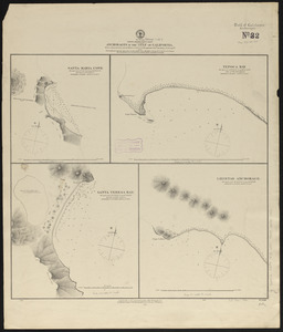
- 1 map on 3 sheets : hand colored ; 176 x 201 cm, on sheets 72 x 120 cm or smaller
- Terms of Use:
-
No known copyright restrictions.
No known restrictions on use.
- Publisher:
-
Washington, D.C. :
Hydrographic Office
- Edition:
- Edition of November 1888
- Scale:
-
Scale approximately 1:690,000
- Language:
-
English
- Table of Contents:
-
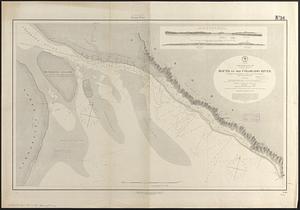
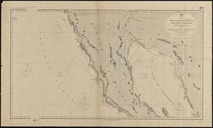
Sheet I. From lat. 29°15' N. to San Diego and the head of the gulf
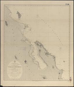
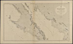
Sheet II. Between the parallels of latitude: 26° and 29°20' N.
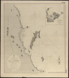
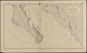
Sheet III. From Cape San Lucas and Mazatlan to lat. 26° N.
- Notes:
-
Relief shown by hachures and spot heights. Depths shown by soundings.
- Notes (date):
-
This date is inferred.
- Identifier:
-
06_01_015663
06_01_015664
06_01_015665
- Call #:
-
G9096.P5 svar .U55 no. 619-621
- Barcode:
-
39999085939385