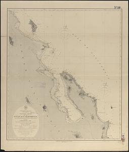
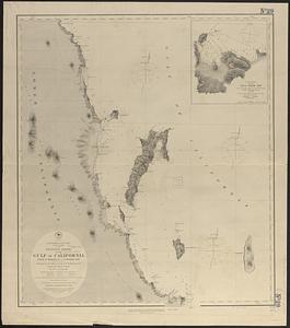
North America, west coast, anchorages in the Gulf of California : from a reconnaissance by the officers of the U.S.S. Narragansett, Comdr. Geo. Dewey, U.S.N. comdg. 1873
Item Information
- Title:
- North America, west coast, anchorages in the Gulf of California : from a reconnaissance by the officers of the U.S.S. Narragansett, Comdr. Geo. Dewey, U.S.N. comdg. 1873
- Title (alt.):
-
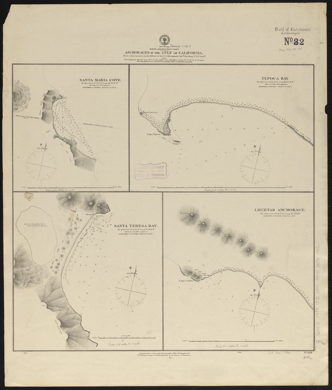
Anchorages in the Gulf of California
- Issuing body:
- United States. Hydrographic Office
- Date:
-
1875
- Format:
-
Maps/Atlases
- Location:
-
Boston Public Library
Norman B. Leventhal Map & Education Center - Collection (local):
-
Norman B. Leventhal Map & Education Center Collection
- Subjects:
-
Anchorage--Mexico--Santa Maria (Baja California Sur)
Nautical charts--Mexico--Tepoca Bay
Nautical charts--Mexico--Santa Teresa Bay
Anchorage--Mexico--Puerto Libertad
California, Gulf of (Mexico)--Maps
Santa Maria (Mexico : Baja California Sur)--Maps
Tepoca Bay (Mexico)--Maps
Santa Teresa Bay (Mexico)--Maps
Puerto Libertad (Mexico)--Maps
- Places:
-
MexicoSonoraTepoca, Bahía de (bay)
MexicoBaja CaliforniaSanta Teresa, Bahía (bay)
MexicoSonoraPuerto Libertad
- Extent:
- 4 maps on 1 sheet ; 50 x 53 cm
- Terms of Use:
-
No known copyright restrictions.
No known restrictions on use.
- Publisher:
-
Washington, D.C. :
Hydrographic Office
- Scale:
-
Scales differ
- Language:
-
English
- Table of Contents:
-
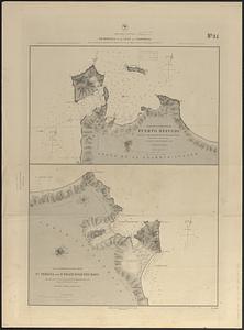
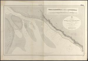
Santa Maria Cove
Tepoca Bay
Santa Teresa Bay
Libertad Anchorage.
- Notes:
-
Relief shown by hachures and spot heights. Depths shown by soundings and isolines.
- Identifier:
-
06_01_015859
- Call #:
-
G9096.P5 svar .U55
- Barcode:
-
39999085940342