Toggle navigation
LMEC Home
Exhibitions
Georeferencing
Tools for Teachers
Collections
My Favorites
Sign Up / Log In
Search
Search the map portal
Map Collection
Map Collection
Map Sets
Search
Search
Search for
Search In
All Fields
Creator
Title
Subject
Place
Search All Digital Collections
Advanced Search
8561 Results
My Search
Start Over
More Like
commonwealth:x633f945h
Remove constraint More Like: commonwealth:x633f945h
Filter your Search
Place
North and Central America
5,856
United States
4,780
Massachusetts
2,057
Europe
1,359
Suffolk (county)
1,034
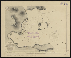
Boston
1,007
Canada
448
Asia
422
more
Place
»
Topic
Boston (Mass.)--Maps
577
United States--Maps
273
Real property--Massachusetts--Boston--Maps
174
Massachusetts--Maps
160
Landowners--Massachusetts--Boston--Maps
132
North America--Maps--Early works to 1800
103
New England--Maps
99
Europe--Maps
78
more
Topic
»
Date
Date range begin
–
Date range end
Current results range from
1482
to
2023
View distribution
Creator
United States. Hydrographic Office
594
O.H. Bailey & Co
148
Des Barres, Joseph F. W. (Joseph Frederick Wallet), 1722-1824
125
United States. Post Office Dept
120
Ptolemy, 2nd cent
100
Walling, Henry Francis, 1825-1888
94
Geological Survey (U.S.)
86
Jefferys, Thomas, -1771
85
more
Creator
»
Format
Maps/Atlases
8,502
Manuscripts
219
Prints
56
Books
36
Objects/Artifacts
10
Drawings/Illustrations
8
Posters
4
Georeferenced
Yes
869
No
7,692
Collection
Norman B. Leventhal Map & Education Center Collection
8,555
Boston and New England Maps
2,209
Urban Maps
1,936
Maritime Charts and Atlases
1,088
American Revolutionary War-Era Maps
626
Boston Redevelopment Authority Collection
87
Mapping Boston Collection
6
Library of Congress Collection
5
more
Collection
»
Available to use
No known restrictions
8,408
Creative Commons license
58
Search Constraints
Sort by relevance
relevance
title
date (asc)
date (desc)
Number of results to display per page
100 per page
10
per page
20
per page
50
per page
100
per page
View results as:
grid view
map view
Search Results
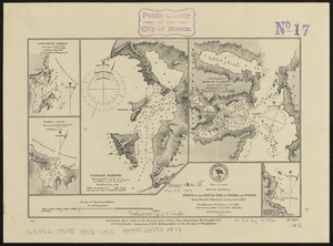
7301.
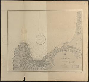
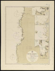
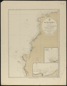
South America, Chili, Valparaiso Bay : from a Chilian survey in 1877
7302.
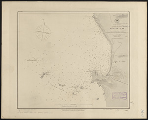
South America, coast of Peru, Ancon Bay : from an Italian survey in 1883
7303.
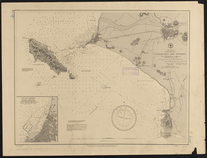
South America, coast of Peru, Callao Bay and vicinity : from a British survey in 1840, and a French survey in 1876
7304.
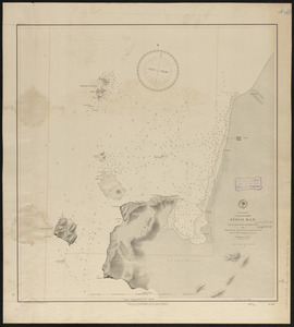
South America, coast of Peru, Pisco Bay : from the latest French and English charts, 1885
7305.
South America divided into its IIII principall parts : I Spanish part: vizt. Firmland, Guiana, Peru, Chili, pt of the country...
7306.
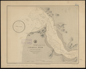
South America, Ecuador, Caraquez River : from a British survey in 1847
7307.
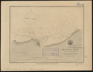
South America, Ecuador, Manta Bay : from a British survey in 1876
7308.
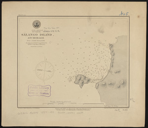
South America, Ecuador, Salango Island anchorage : from a British survey in 1847
7309.
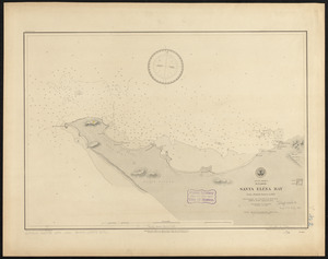
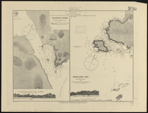
South America, Ecuador, Santa Eléna Bay : from a British survey in 1847
7310.
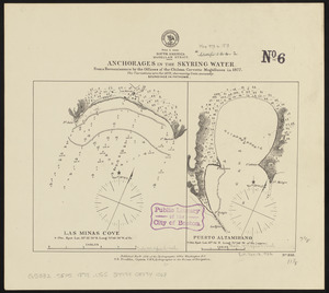
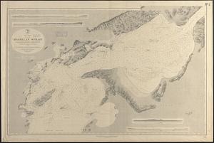
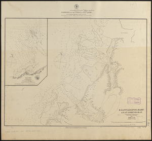
South America, Magellan Strait, anchorages in the Skyring Water : from a reconnaissance by the officers of the Chilean corvette...
7311.
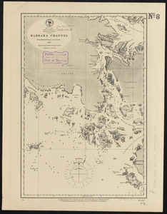
South America, Magellan Strait, Barbara Channel : from British surveys corrected to 1878
7312.
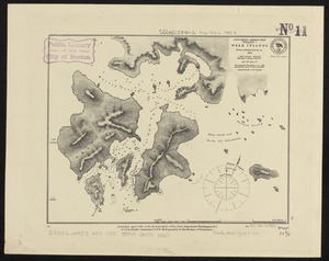
South America-- Magellan Strait, Desolation I., Week Islands : from a British survey in 1830
7313.
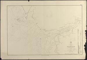
South America, Magellan Strait from the eastern entrance to the First Narrows : compiled from the most recent surveys to 1883
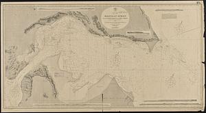
7314.
South America, Magellan Strait from the First Narrows to Broad Reach : compiled from the most recent surveys to 1883
7315.
South America, north coast of Colombia and Venezuela, Gulf of Darien to Puerto Cabello : compiled from the latest information 1886
7316.
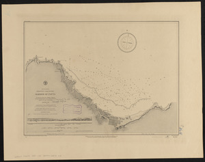
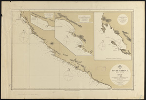
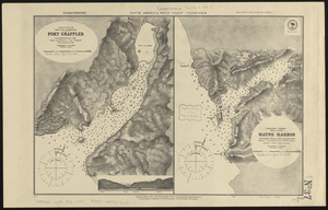
South America, north-west coast of Peru, harbor of Payta
7317.
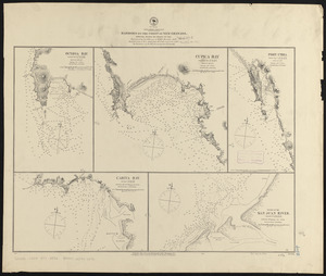
South America, ports in Desolation and Sta. Ines Is. : from British surveys corrected to 1877
7318.
South America, ports in the Strait of Magellan : from British surveys corrected to 1877
7319.
South America, ports on the south side of Tierra del Fuego : from British surveys corrected to 1877
7320.
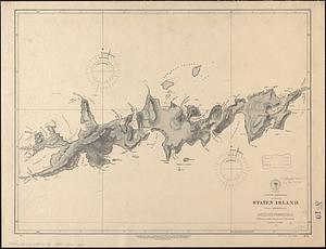
South America, Staten Island : from a British survey
7321.
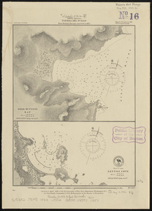
South America, Tierra del Fuego : from British surveys corrected to 1877
7322.
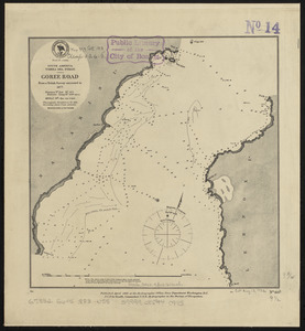
South America, Tierra del Fuego, Goree Road : from a British survey corrected to 1877
7323.
South America, Tierra del Fuego, Packsaddle Bay : from a British survey corrected to 1877
7324.
South America, United States of Colombia, Bahia Honda : from an old Spanish plan 1886
7325.
South America, United States of Colombia, Candelaria Bay : from an old Spanish plan 1886
7326.
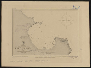
South America, United States of Colombia, Port Carreto : from an old Spanish plan 1886
7327.
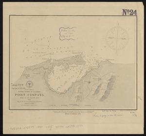
South America, United States of Colombia, Port Cispata, from an old Spanish plan, 1886
7328.
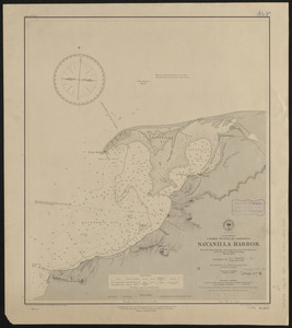
South America, United States of Colombia, Savanilla Harbor : from the latest surveys with corrections by U.S.S. Albatross,...
7329.
South America, west coast : republication of Brit. Admty. chart no. 1374, with additions to 1876
7330.
South America, west coast : republication of Brit. Admty. chart no. 1277, with additions to 1876
7331.
South America, west coast : republication of Brit. Admty. chart no. 1287, with additions to 1876
7332.
South America, west coast : republication of Brit. Admty. chart no. 1286, with additions to 1876
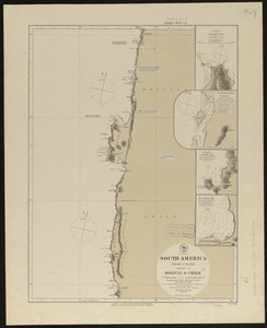
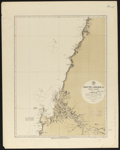
7333.
South America, west coast : republication of Brit. Admty. chart no. 1325, with additions to 1876
7334.
South America, west coast : republication of Brit. Admiralty chart no. 1289, with additions to 1876
7335.
South America, west coast : republication of Brit. Admty. chart no. 1276, with additions to 1876
7336.
South America, west coast : republication of Brit. Admty. chart no. 1282, with additions to 1876
7337.
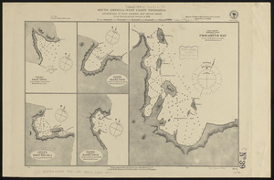
South America, west coast : republication of Brit. Admty. chart no. 1285, with additions to 1877
7338.
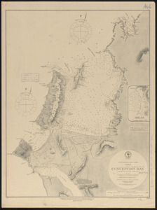
South America-- west coast, Chile, Concepcion Bay : from British and French surveys
7339.
South America, west coast, Chile, Coronel, Lota & Colcura anchorages in Arauco Bay : from a Chilean government survey in 1878
7340.
South America, west coast, Chile, ports on the coast of Chile : special plans to chart no. 753 : from surveys by Capt. Pomar...
7341.
South America, west coast, Ecuador, Guayaquil River : from a British survey in 1847, corrected to 1876 ; republication of Brit....
7342.
South America, west coast, harbors on the coast of Ecuador : from British surveys in 1837 and 1847 ; republication of Brit....
7343.
South America, west coast, harbors on the coast of New Granada : special plans to chart no. 766
7344.
South America, west coast, Nueva Granada, Port Buenaventura : from a British survey in 1846 ; republication of Brit. Admty....
7345.
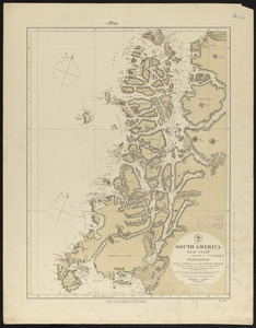
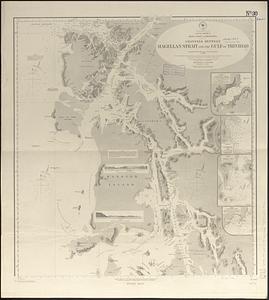
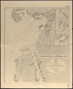
South America, west coast of Patagonia, channels between Magellan Strait and the Gulf of Trinidad : compiled from the most...
7346.
South America, west coast of Patagonia, channels between the Gulfs of Trinidad and of Peñas : compiled from the most recent...
7347.
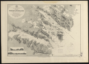
South America-- west coast, Patagonia, Tom Bay anchorages : from British surveys in 1879, corrected to 1882
7348.
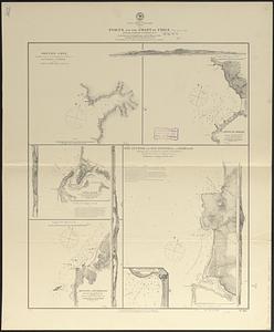
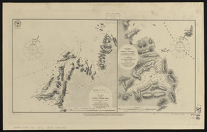
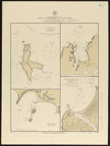
South America, west coast, Port Barbara : from a British survey corrected to 1877 ; South America, west coast, Port Otway in...
7349.
South America, west coast, ports and anchorages on the coast of Chile : special plans to chart no. 752, Santa Maria Id. &...
7350.
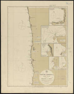
South America, west coast, sheet 10, Bolivia and Peru, C.S. Francisco to Cape Lobos : republication of Brit. Admty. chart no....
7351.
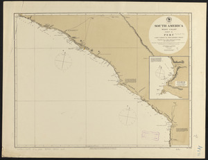
South America, west coast, sheet 11, Peru, Cape Lobos to Pescadores Point : republication of Brit. Admty. chart no. 1283, with...
7352.
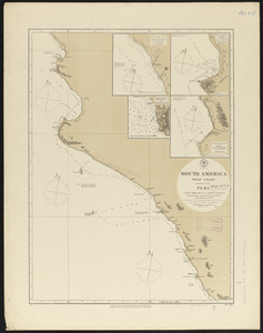
South America, west coast, sheet 13, Peru, Independencia Bay to Begueta : republication of Brit. Admty. chart no. 1323 with...
7353.
South America, west coast, sheet 15, Peru, Chicama Riv. to Port Payta : republication of Brit. Admty. chart no. 1335, with...
7354.
South America, west coast, sheet 17, Ecuador, Ayangui Pt. to Verde Pt : republication of Brit. Admty. chart no. 1814, with...
7355.
South America, west coast, sheet 19, Buenaventura to Cape Marzo : republication of Brit. Admty. chart no. 2258, with additions...
7356.
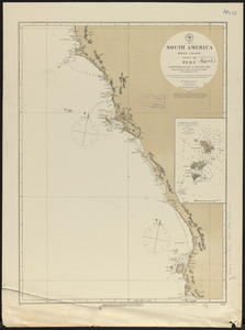
South America, west coast, sheet XII, Peru, Pescadores Pt. to Independencia Bay : republication of Brit. Admty. chart no. 1279,...
7357.
South America, west coast--Patagonia
7358.
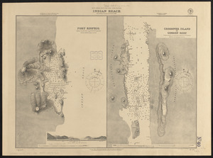
South America--south west coast--inner channels, Indian Reach : from British surveys corrected to 1881
7359.
South America--west coast, anchorages on the coast of Chile : special plans to chart no. 751, Mocha Island, from Brit. surveys...
7360.
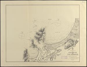
South America--west coast, Chile, Coquimbo Bay and Port Herradura : from a survey by the officers of H.B.M.S. Nassau, 1868 ;...
7361.
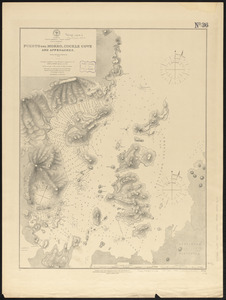
South America--west coast, Gulf of Trinidad, Puerto del Morro, Cockle Cove and approaches : from a British survey in 1879
7362.
South America--west coast, Patagonia, Concepcion Channel
7363.
South America--west coast, Patagonia, harbors and anchorages in Trinidad Channel
7364.
South America--west coast, ports on the coast of Chile : republication of the British Admty. charts nos. 809 & 1312
7365.
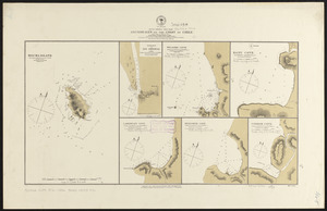
South America--west coast--Patagonia, anchorages in Wide Channel and Indian Reach : from Chilean partial surveys in 1879
7366.
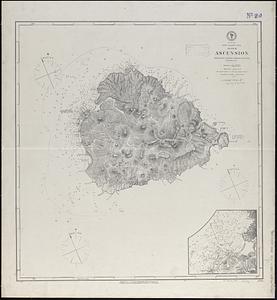
South Atlantic Ocean, Island of Ascension : republication of British Admiralty chart no. 1691, corrected to 1874
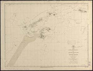
7367.
South Atlantic Ocean, the South Shetland and South Orkney Islands, with the tracks of the several discoverers, 1819 to 1843 :...
7368.
South Bay and Savin Hill parks : Dorchester district
7369.
South Boston
7370.
South Britain or England & Wales : drawn from several surveys &c. on the new projection ; corrected from astronomical...
7371.
South Carolina
7372.
South coast of Newfoundland, Great Miquelon Island, Miquelon Road : from a French survey in 1841
7373.
South coast of Newfoundland, St. Pierre Island, St. Pierre Harbor : from a French survey in 1841, with additions in 1881
7374.
South Cove, in Boston
7375.
The South Cove territory, comprising every part which is coloured on this map
7376.
The south east coast of Cape Breton Island
7377.
The south east coast of the island of St. John : surveyed under the direction of the Right Honourable the Lords of Trade and...
7378.
South Easton, Massachusetts : 1888
7379.
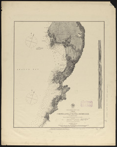
South end of Lake Huron and head of the St. Clair River
7380.
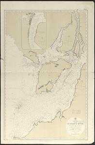
South end of Lake Michigan
7381.
South End urban renewal area project Mass. r-56 : site preparation contract no. 16 street lighting and drainage
7382.
A South Ender's view of the world
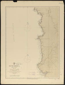
7383.
South entrance of Grand Passage : Cape St. Mary, N:E: one mile ; St. Mary's Bay
7384.
South extreme of America, Hermite Island, St. Martin Cove : from British surveys corrected to 1877
7385.
South extreme of America, Wollaston Islands : from British surveys corrected to 1878
7386.
South Framingham, Massachusetts
7387.
South Framingham, Massachusetts : 1882
7388.
South Germany, (Bavaria, &c.)
7389.
South Italy
7390.
South Manchuria
7391.
South Mountain showing the positions of the forces of the United States and the enemy during the battle fought by the Army of...
7392.
South New Market : Rockingham County, N.H. 1884
7393.
South Norwalk and Norwalk, Conn : 1875
7394.
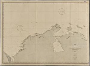
South Pacific
7395.
South Pacific, Fiji or Viti Group, Matuku ; Matuku Harbor
7396.
South Pacific, Fiji or Viti Group, Moala
7397.
South Pacific, Fiji or Viti Group, Nairai & Mbatiki Islands
7398.
South Pacific, Fiji or Viti Group, Ngau Island and Mumbolithe Reef
7399.
South Pacific, Fiji or Viti Group, Totoya
7400.
South Pacific, harbors in the Solomon Islands and in the neighboring groups : republication of Brit. Admty. chart no. 769
‹ Prev
Next ›
1
2
…
70
71
72
73
74
75
76
77
78
…
85
86