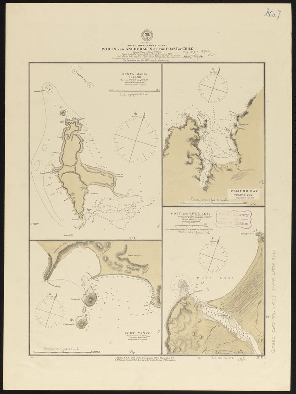
South America, west coast, ports and anchorages on the coast of Chile : special plans to chart no. 752, Santa Maria Id. & Coliumo Bay, from British surveys in 1835 ; Port & River Lebu and Port Yañez from Chilean surveys in 1862 & 66
Item Information
- Title:
- South America, west coast, ports and anchorages on the coast of Chile : special plans to chart no. 752, Santa Maria Id. & Coliumo Bay, from British surveys in 1835 ; Port & River Lebu and Port Yañez from Chilean surveys in 1862 & 66
- Title (alt.):
-
Ports and anchorages on the coast of Chile
- Issuing body:
- United States. Hydrographic Office
- Date:
-
1876
- Format:
-
Maps/Atlases
- Location:
-
Boston Public Library
Norman B. Leventhal Map & Education Center - Collection (local):
-
Norman B. Leventhal Map & Education Center Collection
- Subjects:
-
Coasts--Chile--Maps
Harbors--Chile--Lebu
Nautical charts--Chile--Santa María Island (Biobío)
Nautical charts--Chile--Coliumo Bay
Nautical charts--Chile--Yane Harbor
Santa María Island (Biobío, Chile)--Maps
Coliumo Bay (Chile)--Maps
Puerto Yane (Chile)--Maps
Lebu River (Chile)--Maps
- Places:
-
ChileBiobío (region)Coliumo, Bahía (bay)
ChileBiobío (region)Yane, Puerto (harbor)
ChileBiobío (region)Lebu, Río (stream)
- Extent:
- 4 maps on 1 sheet ; 46 x 38 cm
- Terms of Use:
-
No known copyright restrictions.
No known restrictions on use.
- Publisher:
-
Washington, D.C. :
Hydrographic Office
- Scale:
-
Scale approximately 1:20,100
Scale approximately 1:20,200
Scale approximately 1:37,000
Scale approximately 1:74,500
- Language:
-
English
- Table of Contents:
-
Santa Maria Island
Coliumo Bay
Port Yañez
Port and River Lebu.
- Notes:
-
Relief shown by hachures and spot heights. Depths shown by soundings and isolines.
- Identifier:
-
06_01_015772
- Call #:
-
G9096.P5 svar .U55
- Barcode:
-
39999085939690


