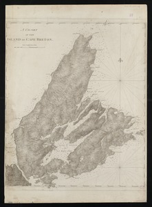
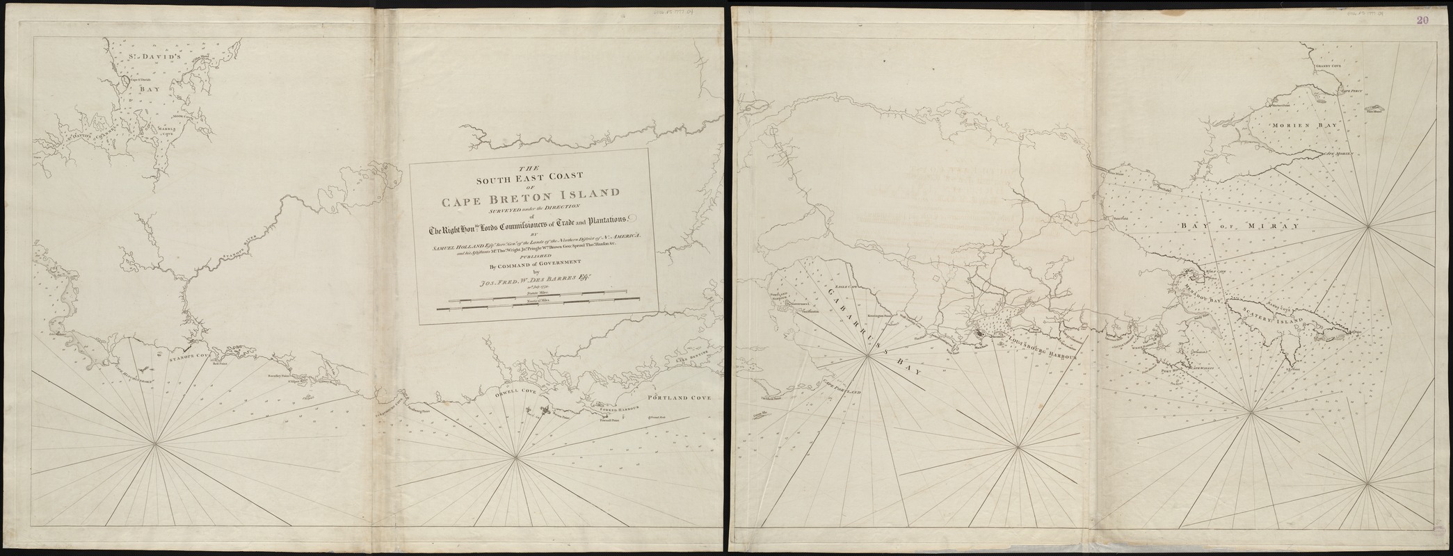
The south east coast of Cape Breton Island
This map is also available in American Revolutionary Geographies Online (ARGO), a collections portal especially built for material relating to the American Revolutionary War Era. Visit ARGO to learn more about this item and explore the historical geography of North America in the late eighteenth century.
Item Information
- Title:
- The south east coast of Cape Breton Island
- Title (alt.):
-
Southeast coast of Cape Breton Island
- Creator:
- Holland, Samuel, 1728-1801
- Name on Item:
-
surveyed under the direction of the right honble. Lords Commissioners of Trade and Plantations by Samuel Holland Esqr., Survr. Genl. of the lands of the northern district of N. America, and his assistants Mr. Thos. Wright, Jno. Pringle, Wm. Brown, Geo. Sproul, Thos. Hanson, &c.
- Date:
-
1779
- Format:
-
Maps/Atlases
- Location:
-
Boston Public Library
Norman B. Leventhal Map & Education Center - Collection (local):
-
Norman B. Leventhal Map & Education Center Collection
- Subjects:
-
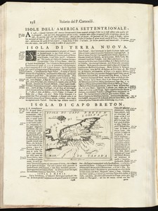
Coasts--Nova Scotia--Cape Breton Island--Maps--Early works to 1800
Nautical charts--Nova Scotia--Cape Breton Island--Early works to 1800
Cape Breton Island (N.S.)--Maps--Early works to 1800
- Places:
-
CanadaNova Scotia (province)Cape Breton Island (island)
- Extent:
- 1 map on 2 sheets ; 74 x 208 cm., sheets 78 x 106 cm.
- Terms of Use:
-
No known copyright restrictions.
No known restrictions on use.
- Publisher:
-
[London] :
Jos. Fred. W. Des Barres
- Scale:
-
Scale [ca. 1:48,000]
- Language:
-
English
- Notes:
-
Depths shown by soundings.
Appears in the author's Atlantic Neptune. London : J.F.W. Des Barres, 1777-[1781].
Oriented with north toward the upper right.
Watermarks include "JBates."
- Identifier:
-
06_01_004966
- Call #:
-
G1106.P5 D47 1777
- Barcode:
-
30000003805365