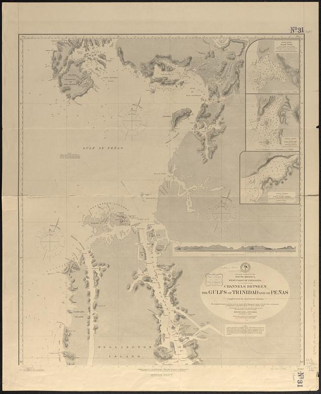
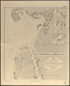
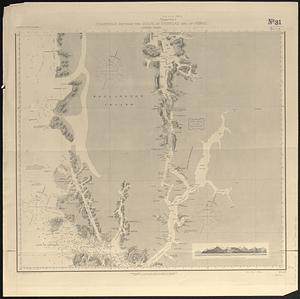
South America, west coast of Patagonia, channels between the Gulfs of Trinidad and of Peñas : compiled from the most recent surveys
Item Information
- Title:
- South America, west coast of Patagonia, channels between the Gulfs of Trinidad and of Peñas : compiled from the most recent surveys
- Issuing body:
- United States. Hydrographic Office
- Date:
-
[1888]
- Format:
-
Maps/Atlases
- Genre:
-
Nautical charts
- Location:
-
Boston Public Library
Norman B. Leventhal Map & Education Center - Collection (local):
-
Norman B. Leventhal Map & Education Center Collection
- Subjects:
-
Penas, Gulf of (Chile)--Maps
Wellington Island (Chile)--Maps
Trinidad, Gulf of (Chile)--Maps
Nautical charts--Chile--Penas, Gulf of
Nautical charts--Chile--Wellington Island
Nautical charts--Chile--Trinidad, Gulf of
- Places:
-
ChileAysén (region)Penas, Golfo de (gulf)
ChileMagallanes y de la Antártica Chilena (region)Wellington, Isla (island)
ChileMagallanes y de la Antártica Chilena (region)Trinidad, Golfo (bay)
- Extent:
- 1 map on 2 sheets ; 123 x 62 cm, on sheets 87 x 71 cm and 72 x 72 cm
- Terms of Use:
-
No known copyright restrictions.
No known restrictions on use.
- Publisher:
-
Washington, D.C. :
Hydrographic Office
- Scale:
-
Scale approximately 1:330,000
- Language:
-
English
- Table of Contents:
-
Upper part
Lower part
- Notes:
-
Relief shown by hachures and spot heights. Depths shown by soundings.
Insets: Hale Cove -- Island Hr. -- Connor Cove.
Includes 2 coastal views.
"Cor. (1888-4." and "Cor. (1885-223.362)(1888-4.35.47."
- Notes (date):
-
This date is inferred.
- Identifier:
-
06_01_017404A
06_01_017404B
- Call #:
-
G9096.P5 svar .U55 no. 447
- Barcode:
-
39999085959094


