South America, west coast--Patagonia
Item Information
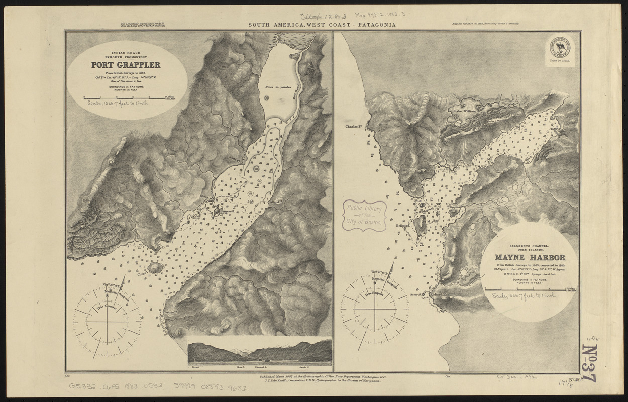
- Title:
- South America, west coast--Patagonia
- Title (alt.):
-
Port Grappler
Mayne Harbor
Indian Reach, Exmouth Promontory, Port Grappler
Sarmiento Channel, Owen Islands, Mayne Harbor
- Issuing body:
- United States. Hydrographic Office
- Date:
-
1883
- Format:
-
Maps/Atlases
- Location:
-
Boston Public Library
Norman B. Leventhal Map & Education Center - Collection (local):
-
Norman B. Leventhal Map & Education Center Collection
- Subjects:
-
Coasts--Chile--Maps
Nautical charts--Chile--Grappler Harbor
Nautical charts--Chile--Mayne Harbor
Grappler Harbor (Chile)--Maps
Mayne Harbor (Chile)--Maps
- Places:
-
ChileMagallanes y de la Antártica Chilena (region)Grappler, Puerto (harbor)
ChileMagallanes y de la Antártica Chilena (region)Mayne, Puerto (harbor)
- Extent:
- 2 maps on 1 sheet ; 30 x 45 cm
- Terms of Use:
-
No known copyright restrictions.
No known restrictions on use.
- Publisher:
-
Washington, D.C. :
Hydrographic Office
- Scale:
-
Scale approximately 1:13,100
Scale approximately 1:13,200
- Language:
-
English
- Table of Contents:
-
Indian Reach, Exmouth Promontory, Port Grappler
Sarmiento Channel, Owen Islands, Mayne Harbor.
- Notes:
-
Relief shown by hachures and spot heights. Depths shown by soundings and isolines.
Includes view of entrance to Puerto Grappler.
- Identifier:
-
06_01_015827
- Call #:
-
G9096.P5 svar .U55
- Barcode:
-
39999085939633


