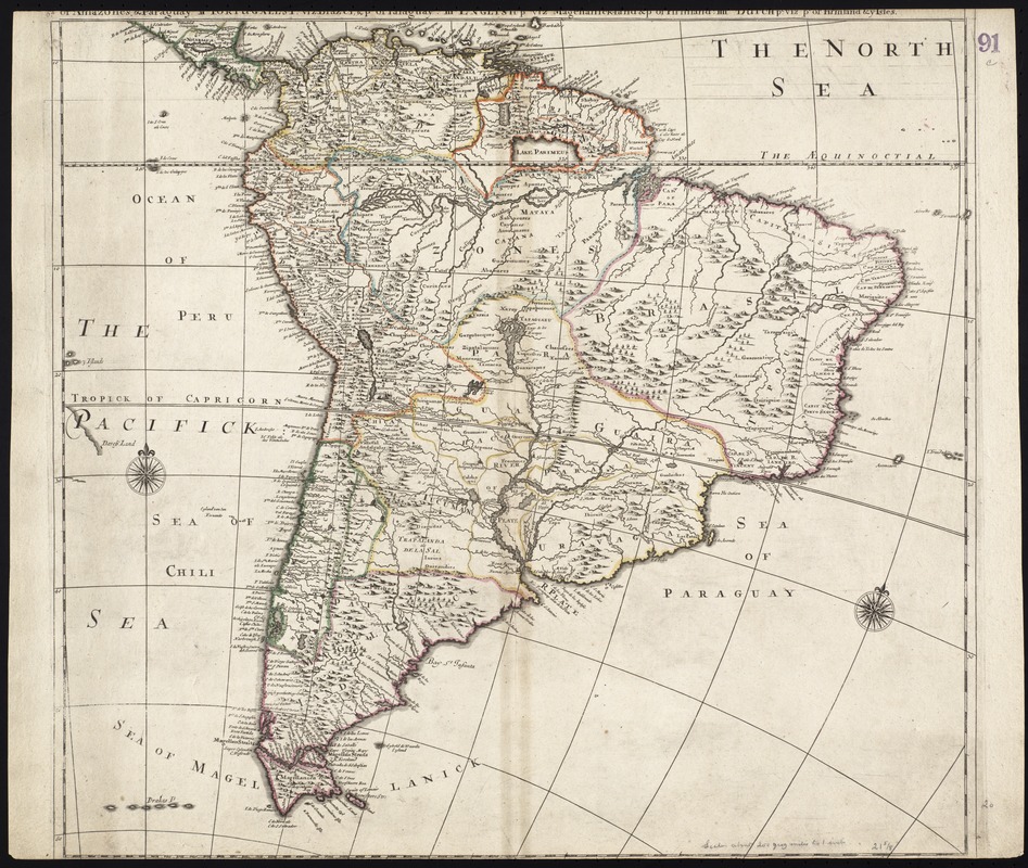
South America divided into its IIII principall parts : I Spanish part: vizt. Firmland, Guiana, Peru, Chili, pt of the country of Amazones, & Paraguay: III English pt vizt Magellanick-land & pt of Firmland: IIII Dutch pt vizt pt of Firmland & ye isles
Item Information
- Title:
- South America divided into its IIII principall parts : I Spanish part: vizt. Firmland, Guiana, Peru, Chili, pt of the country of Amazones, & Paraguay: III English pt vizt Magellanick-land & pt of Firmland: IIII Dutch pt vizt pt of Firmland & ye isles
- Title (alt.):
-
Collection of old maps
- Creator:
- Lea, Philip, fl. 1683-1700
- Date:
-
[ca. 1684]
- Format:
-
Maps/Atlases
- Location:
-
Boston Public Library
Norman B. Leventhal Map & Education Center - Collection (local):
-
Norman B. Leventhal Map & Education Center Collection
- Subjects:
-
South America--Maps--Early works to 1800
- Places:
-
South America
South America
- Extent:
- 1 map : col. ; 52 x 56 cm.
- Terms of Use:
-
No known copyright restrictions.
No known restrictions on use.
- Publisher:
-
London :
s.n.
- Scale:
-
Scale [ca. 1:15,000,000]
- Language:
-
English
- Notes:
-
Relief shown pictorially.
Title is partially damaged.
Cataloging, conservation, and digitization made possible in part by The National Endowment for the Humanities: Exploring the human endeavor.
Part of composite portfolio atlas with title "Collection of old maps."
- Identifier:
-
06_01_009286
- Call #:
-
G1015 .C65 1630
- Barcode:
-
30000003858167


