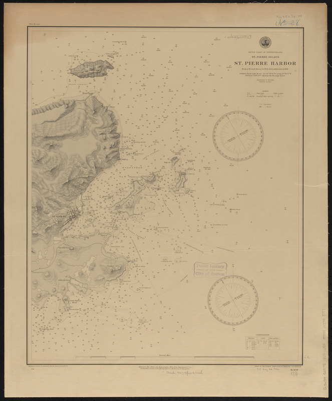
South coast of Newfoundland, St. Pierre Island, St. Pierre Harbor : from a French survey in 1841, with additions in 1881
Item Information
- Title:
- South coast of Newfoundland, St. Pierre Island, St. Pierre Harbor : from a French survey in 1841, with additions in 1881
- Title (alt.):
-
St. Pierre Harbor
- Issuing body:
- United States. Hydrographic Office
- Engraver:
- Enthoffer, E. J. (Edward J.)
- Engraver:
- Gasch, H. E. (Herman E.)
- Draftsman:
- Latimer, J. S. (Joseph S.)
- Name on Item:
-
drawn by Jos. S. Latimer ; engraved by E.J. Enthoffer and H.E. Gasch
- Date:
-
1888
- Format:
-
Maps/Atlases
- Location:
-
Boston Public Library
Norman B. Leventhal Map & Education Center - Collection (local):
-
Norman B. Leventhal Map & Education Center Collection
- Subjects:
-
Coasts--Saint Pierre and Miquelon--Saint-Pierre (Island)--Maps
Harbors--Saint Pierre and Miquelon--Saint-Pierre--Maps
Nautical charts--Saint Pierre and Miquelon--Saint-Pierre--Maps
Saint-Pierre (Saint Pierre and Miquelon)--Maps
- Places:
-
Saint Pierre and Miquelon (territory)Saint-Pierre (island)Saint-Pierre
- Extent:
- 1 map ; 56 x 46 cm
- Terms of Use:
-
No known copyright restrictions.
No known restrictions on use.
- Publisher:
-
Washington, D.C. :
Hydrographic Office
- Scale:
-
Scale approximately 1:18,300
- Language:
-
English
- Notes:
-
Relief shown by shading, form lines and spot heights. Depths shown by soundings and form lines.
- Identifier:
-
06_01_015567
- Call #:
-
G9096.P5 svar .U55
- Barcode:
-
39999085938197


