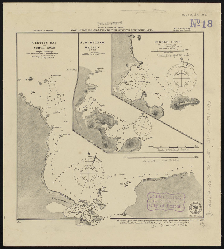
South extreme of America, Wollaston Islands : from British surveys corrected to 1878
Item Information
- Title:
- South extreme of America, Wollaston Islands : from British surveys corrected to 1878
- Title (alt.):
-
Wollaston Islands
- Issuing body:
- United States. Hydrographic Office
- Date:
-
1883
- Format:
-
Maps/Atlases
- Location:
-
Boston Public Library
Norman B. Leventhal Map & Education Center - Collection (local):
-
Norman B. Leventhal Map & Education Center Collection
- Subjects:
-
Nautical charts--Chile--Gretton Bay
Nautical charts--Chile--Rada Norte
Nautical charts--Chile--Scourfield Bay
Nautical charts--Chile--Hately Bay
Nautical charts--Chile--Middle Cove
Wollaston Island (Chile)--Maps
Gretton Bay (Chile)--Maps
Rada Norte (Chile)--Maps
Scourfield Bay (Chile)--Maps
Hately Bay (Chile)--Maps
Middle Cove (Chile)--Maps
- Places:
-
ChileMagallanes y de la Antártica Chilena (region)Gretton, Bahía (bay)
ChileMagallanes y de la Antártica Chilena (region)Lynch, Roca (rock)
ChileMagallanes y de la Antártica Chilena (region)Scourfield, Bahía (bay)
ChileMagallanes y de la Antártica Chilena (region)Hately, Bahía (bay)
ChileMagallanes y de la Antártica Chilena (region)Middle, Caleta (cove)
Rada Norte
- Extent:
- 3 maps on 1 sheet ; 29 x 28 cm
- Terms of Use:
-
No known copyright restrictions.
No known restrictions on use.
- Publisher:
-
Washington, D.C. :
Hydrographic Office
- Scale:
-
Scale approximately 1:37,500
Scale approximately 1:74,100
Scale approximately 1:150,000
- Language:
-
English
- Table of Contents:
-
Gretton Bay and North Road
Scourfield and Hately Bays
Middle Cove.
- Notes:
-
Relief shown by hachures. Depths shown by soundings.
- Identifier:
-
06_01_015898
- Call #:
-
G9096.P5 svar .U55
- Barcode:
-
39999085941035


