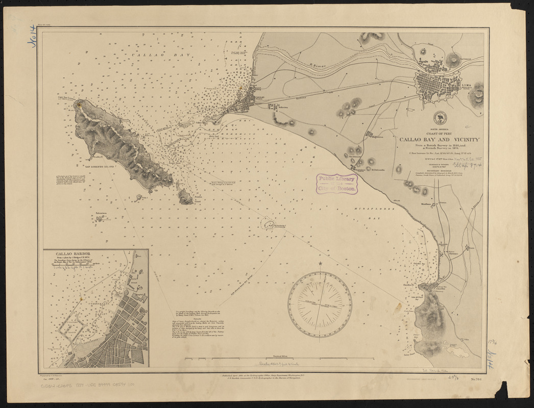
South America, coast of Peru, Callao Bay and vicinity : from a British survey in 1840, and a French survey in 1876
Item Information
- Title:
- South America, coast of Peru, Callao Bay and vicinity : from a British survey in 1840, and a French survey in 1876
- Title (alt.):
-
Callao Bay and vicinity
- Issuing body:
- United States. Hydrographic Office
- Draftsman:
- Petersen, C. F. (Charles F.)
- Printer:
- Leggo Bros. & Co.
- Name on Item:
-
prepared by C.F. Petersen
- Date:
-
1888
- Format:
-
Maps/Atlases
- Location:
-
Boston Public Library
Norman B. Leventhal Map & Education Center - Collection (local):
-
Norman B. Leventhal Map & Education Center Collection
- Subjects:
-
Harbors--Peru--Callao (Callao)--Maps
Nautical charts--Peru--Callao Bay
Callao Bay (Peru)--Maps
- Places:
-
PeruCallao (region)Callao
- Extent:
- 1 map ; 46 x 60 cm
- Terms of Use:
-
No known copyright restrictions.
No known restrictions on use.
- Publisher:
-
Washington, D.C. :
Hydrographic Office
- Scale:
-
Scale approximately 1:50,800
- Language:
-
English
- Notes:
-
Relief shown by hachures and spot heights. Depths shown by soundings and isolines.
Inset: Callao Harbor.
"Cor. 1888-24."
- Identifier:
-
06_01_015891
- Call #:
-
G9096.P5 svar .U55
- Barcode:
-
39999085941100


