Toggle navigation
LMEC Home
Exhibitions
Georeferencing
Tools for Teachers
Collections
My Favorites
Sign Up / Log In
Search
Search the map portal
Map Collection
Map Collection
Map Sets
Search
Search
Search for
Search In
All Fields
Creator
Title
Subject
Place
Search All Digital Collections
Advanced Search
8562 Results
My Search
Start Over
More Like
commonwealth:kk91fr709
Remove constraint More Like: commonwealth:kk91fr709
Filter your Search
Place
North and Central America
5,857
United States
4,776
Massachusetts
2,052
Europe
1,359
Suffolk (county)
1,034
Boston
1,007
Canada
448
Asia
422
more
Place
»
Topic
Boston (Mass.)--Maps
577
United States--Maps
273
Real property--Massachusetts--Boston--Maps
174
Massachusetts--Maps
160
Landowners--Massachusetts--Boston--Maps
132
North America--Maps--Early works to 1800
103
New England--Maps
99
Europe--Maps
78
more
Topic
»
Date
Date range begin
–
Date range end
Current results range from
1482
to
2023
View distribution
Creator
United States. Hydrographic Office
594
O.H. Bailey & Co
148
Des Barres, Joseph F. W. (Joseph Frederick Wallet), 1722-1824
123
United States. Post Office Dept
120
Ptolemy, 2nd cent
100
Walling, Henry Francis, 1825-1888
94
Geological Survey (U.S.)
86
Jefferys, Thomas, -1771
86
more
Creator
»
Format
Maps/Atlases
8,503
Manuscripts
215
Prints
56
Books
36
Objects/Artifacts
10
Drawings/Illustrations
8
Posters
4
Georeferenced
Yes
869
No
7,693
Collection
Norman B. Leventhal Map & Education Center Collection
8,549
Boston and New England Maps
2,204
Urban Maps
1,936
Maritime Charts and Atlases
1,081
American Revolutionary War-Era Maps
629
Boston Redevelopment Authority Collection
87
William L. Clements Library Collection
8
American Antiquarian Society Collection
5
Available to use
No known restrictions
8,408
Creative Commons license
46
Search Constraints
Sort by relevance
relevance
title
date (asc)
date (desc)
Number of results to display per page
100 per page
10
per page
20
per page
50
per page
100
per page
View results as:
grid view
map view
Search Results
1.
The Keystone group : a new railroad, post-office, township and district map of Pennsylvania, New Jersey, Delaware, Maryland,...
2.
Map of the Virginian Railway
3.
Map of Virginia, West Virginia and Ohio : showing Norfolk and Western Railway : main line branches and connections
4.
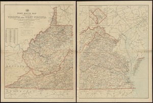
Post route map of the states of Virginia and West Virginia showing post offices with the intermediate distances and mail routes...
5.
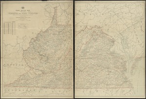
Post route map of the states of Virginia and West Virginia showing post offices with the intermediate distances on mail routes...
6.
Post route map of the states of Virginia and West Virginia showing post offices with the intermediate distances on mail routes...
7.
Bacon's Map of the seat of war in Virginia : showing minutely the interesting localities in the vicinity of Richmond
8.
Coast of North Carolina & Virginia
9.
Colton's new topographical map of the states of Virginia, Maryland & Delaware, showing also eastern Tennessee & parts of other...
10.
Colton's new topographical map of the states of Virginia, West Virginia, Maryland & Delaware and portions of other adjoining...
11.
Fort Monroe and vicinity showing entrance to Chesapeake Bay, Norfolk, Portsmouth, Gosport Navy Yard &c
12.
Johnson's Virginia, Delaware, Maryland & West Virginia
13.
Lloyd's official map of the state of Virginia from actual surveys by order of the Executive, 1828 & 1859
14.
Map of eastern Virginia
15.
Map of eastern Virginia
16.
Map of n. eastern Virginia and vicinity of Washington
17.
Map of the State of Virginia
18.
Map of the State of Virginia
19.
Map of the vicinity of Yorktown, Virginia, 1881
20.
Map of Virginia and Maryland, constructed from the latest authorities
21.
Map of Virginia and West Virginia
22.
Middle Virginia and North Carolina
23.
The new war map of Virginia, Maryland & Pennsylvania
24.
Official map of the state of Virginia : from actual surveys by order of the executive, 1828 & 1859
25.
Post route map of the states of Virginia and West Virginia together with Maryland and Delaware with adjacent parts of...
26.
Scarborough's new county and post office map of Virginia, Maryland, Delaware, and District of Columbia : with complete index...
27.
The seat of war : birds eye view of Virginia, Maryland, Delaware, and the District of Columbia
28.
Seat of war in Virginia and Maryland
29.
Smith's topographical map of Virginia and Maryland
30.
State of Virginia : stations and transmission lines used in public service in 1925 and gaging stations
31.
State of Virginia coal fields and producing districts, September 1919
32.
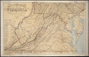
The state of Virginia from the best authorities
33.
The tourist's pocket map of the state of Virginia : exhibiting its internal improvements, roads, distances &c
34.
Virginia
35.
Carte de la Virginie, : de la Baye Chesapeack, et pays voisins. : Pour servir à l'Histoire générale des voyages. : Tirée...
36.
Confluence of the James River, York River, and Chesapeake Bay
37.
Delaware Bay and Chesapeake Bay
38.
Delaware Bay and Chesapeake Bay
39.
A map of the country between Will's Creek & Monongahela River shewing the rout and encampments of the English army, in 1755
40.
A map of the Delaware and Chesapeak bays with the peninsula between them
41.
A Map of the western parts of the colony of Virginia
42.
A map of the western parts of the colony of Virginia
43.
Plan of part of the province of Virginia
44.
The State of Virginia form the best authorities. 1799
45.
The State of Virginia from the best authorities. 1796
46.
Virginia
47.
Yorktown, Virginia, and the surrounding area, ca. 1781
48.
The 100th anniversary map of Abraham Lincoln's visit to Massachusetts, September 11-23, 1848
49.
1630 shoreline
50.
1879. Progress map of the U.S. Geographical Surveys west of the 100th Meridian : prepared under the direction of 1st Lieut....
51.
1903 Map of Salem and surrounding places
52.
19th annual convention of the National Association of Real Estate Boards : at Tulsa, June 7 to June 11 in 1926
53.
2005 significant U.S. hurricane strikes
54.
The 2100 project : an atlas for the Green New Deal
55.
227 Harzgerode
56.
305 Glatz
57.
38,000,000 escaped -- 10,000,000 died
58.
4 Kinten
59.
660 Wakulah St., Roxbury
60.
[A chart of Boston Bay and vicinity]
61.
[A chart of New York Island & North River : East River, passage through Hell Gate, Flushing Bay, Hampstead Bay, Oyster,...
62.
The A.A.A. key road map of continental Europe
63.
Aaron Bohrod's America, its history
64.
ABC pathfinder railway guide map : eastern division
65.
Abolition of Slavery, 1863
66.
Aboriginal map of North America, denoting the boundaries and the locations of various Indian tribes
67.
Acapulco, México
68.
Accurata delineatio Castrorum Suecicorum, ut et Haffniae, Regni Daniae Metropolis
69.
Accurata delineatio oppugnatae a faederatis, Caesareis, Polonicis, Danicis, et Brandeburgicis copijs sub-ductu Seren: Electoris...
70.
Accurata delineatio regionis circa Nieburgum Fioniæ cum prælio ibi commisso inter Danorum et fæderatorum exercitum ab una et...
71.
Accurata Scaniae, Blekingiae et Hallandiae descriptio
72.
An accurate map of Cuba, and the adjacent islands
73.
An accurate map of Dorset Shire divided into hundreds
74.
An accurate map of Dorset Shire, divided into its hundreds
75.
An accurate map of England and Wales with the principal roads from the best authorities
76.
An accurate map of England and Wales with the principal roads from the best authorities
77.
An accurate map of Europe from the best authorities
78.
An accurate map of Hindostan or India, from the best authorities
79.
An accurate map of His Majesty's province of New-Hampshire in New England : taken from actual surveys of all the inhabited...
80.
An Accurate map of New Hampshire in New England, from a late survey
81.
An Accurate map of New York in North America, from a late survey
82.
An accurate map of North America : describing and distinguishing the British, Spanish and French dominions on this great...
83.
An accurate map of North America : describing and distinguishing the British and Spanish dominions on this great continent :...
84.
An accurate map of North America : describing and distinguishing the British and Spanish dominions of this great continent;...
85.
An accurate map of North and South Carolina with their Indian frontiers, shewing in a distinct manner all the mountains,...
86.
An accurate map of Rhode Island, part of Connecticut and Massachusets, shewing Admiral Arbuthnot's station in blocking up...
87.
An accurate map of the coast of Cape de Verde
88.
An accurate map of the Commonwealth of Massachusetts exclusive of the district of Maine : compiled pursuant to an Act of the...
89.
An accurate map of the country round Boston in New England from the best authorities
90.
An accurate map of the county of Essex, divided into its hundreds
91.
An accurate map of the district of Maine being part of the Commonwealth of Massachusetts : compiled pursuant to an act of the...
92.
An accurate map of the United States of America, with part of the surrounding provinces agreeable to the Treaty of Peace of 1783
93.
Accuratissima Brasiliae tabula
94.
Accuratissima Circuli Saxoniae tabula quae est pars septentrionalis Germaniae
95.
Accuratissima Dominii Veneti in Italia, Ducatus Parmae, Placentiae, Modenae Regii Et Mantuae, Episcopatus Tridentini Tabula...
96.
Accuratissima et maxima totius Turcici Imperii tabula cum omnibus suis regionibus novissima delineatio
97.
Accuratissima principatus Cataloniae, et comitatuum Ruscinonis, et Cerretaniae descriptio
98.
An actual survey of the sea coast from New York to the I. Cape Briton : with tables of the direct and thwart courses &...
99.
Adams, Mass : 1882
100.
Adriatic
‹ Prev
Next ›
1
2
3
4
5
…
85
86


![[A chart of Boston Bay and vicinity]](https://bpldcassets.blob.core.windows.net/derivatives/images/commonwealth:cj82m2976/image_thumbnail_300.jpg)


